miércoles, 25 de marzo de 2009

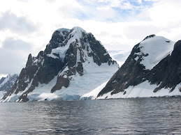
La era del deshielo


El calentamiento global, en mayor o menor medida, se hace
sentir en cada rincón del mundo y el sur argentino con sus
glaciares y nieves eternas, no es la excepción. El hielo retrocede
y deja tras de sí muchas incógnitas.
IMAGEN ©


En tiempos en los que el cambio climático está en boca de
todos y sus efectos negativos se hacen notar en las grandes
masas de hielo de los cinco continentes, Groenlandia
y ambos polos, bien valdría la pena preguntarse qué sucede
con los glaciares de la Patagonia. ¿Están en retroceso?
¿Qué factores entran en juego para que los enormes colosos
de hielo estén perdiendo su masa? ¿Es posible que
desaparezcan antes del próximo siglo?
Lo cierto es que la existencia de los glaciares es fundamental
para la vida, por varios motivos. Éstos constituyen
-junto con los acuíferos, lagos y ríos- una de las principales
reservas de agua dulce del planeta, recurso natural irremplazable
que comienza a escasear en diversos lugares. Son
los glaciares de alta montaña los que alimentan el caudal
de los ríos, permitiendo la generación de energía hidroeléctrica,
el riego y, por lo tanto, la agricultura y el desarrollo
de otras actividades económicas. A esto debería sumarse
el gran valor e interés turístico que han despertado
los glaciares, sobre todo, los que componen el Campo de
Hielo Sur en la provincia de Santa Cruz, con el glaciar Perito
Moreno como estrella principal. Ya en un tono más “científico”,
los glaciares forman parte de la criósfera (porción
de la Tierra cubierta de hielo y nieve), cuyo rol es fundamental
en la regulación del sistema climático global.
La nieve y el hielo tienen un alto grado de “albedo”, es
decir, reflejan la mayor parte de la radiación solar que
reciben. Algunas partes de la Antártida reflejan el 90 %
de la radiación solar, comparado con el promedio global
de tan sólo el 30 %. Sin la criósfera, el albedo global
sería mucho más bajo y la mayor parte de la energía
sería absorbida por la superficie terrestre en lugar de
ser reflejada y, en consecuencia, se produciría un aumento
de la temperatura.

Los Glaciares


“Los glaciares forman parte de
la criósfera (porción de la Tierra
cubierta de hielo y nieve), cuyo rol
es fundamental en la regulación del
sistema climático global”


En Argentina, pueden encontrarse glaciares a lo largo
de las altas cumbres de la Cordillera de los Andes, desde
Salta hasta Tierra del Fuego y en el Campo de Hielo
Sur, en la provincia de Santa Cruz. Otros países de América
Latina como Ecuador, Colombia, Venezuela, Perú,
Bolivia y Chile también poseen glaciares, algunos, en
estado muy avanzado de retroceso, como es el caso de
los hielos peruanos, que representan el 70 % de los glaciares
de zonas subtropicales del mundo y, que según
los expertos, podrían desaparecer antes de 2020.
Los glaciares -“toda masa de hielo perenne, formada
por acumulación de nieve”, según reza la definición
más básica- aumentan su volumen a través del apisonamiento
estrato por estrato de las precipitaciones
níveas, proceso llamado “diagénesis”. A su vez, los glaciares
también pierden parte de su masa por fusión de
hielo y desprendimiento de témpanos, cuya gran parte
de la ablación sucede sobre su superficie o en su frente.
A través del cálculo de la diferencia entre la acumulación
y la disminución de hielo, llamado “balance de
masa”, los expertos pueden saber si un glaciar avanza o
retrocede: si el balance de masa es negativo, el glaciar
perdió más hielo del que ganó y, si resulta positivo, el
glaciar acumuló más hielo del que perdió por fusión.
Asimismo, los glaciares poseen una “línea de equilibrio”,
la cual delimita la superficie de acumulación de
hielo. Mientras más baja sea esta línea, mayor será el
área de depósito de precipitaciones y viceversa.
Por último -y para no aburrir al lector con datos técnicos
que, por otro lado, ayudarán a la hora de comprender
el estado de situación de los glaciares de la Patagonia-,
diremos que éstos pueden clasificarse según su dinámica,
es decir, sean activos (se mueven rápidamente),
pasivos (fluyen lentamente) o inactivos (no presentan
movimiento). También pueden diferenciarse por su estado
físico: fríos (la temperatura del hielo es inferior a
0 °C en la zona de acumulación, por lo cual la ablación
es generalmente escasa, siendo uno de sus mayores
exponentes la Antártida) y temperados (la temperatura
del hielo es sólo unos grados inferior al punto de
fusión, por lo cual reaccionan relativamente rápido a
los cambios climáticos, siendo ejemplo de esta clase la
mayoría de los glaciares patagónicos.Qué dicen los expertos
Investigadores de Argentina y otros países se han
abocado al estudio, variación y comportamiento de
los glaciares en distintos puntos del país y han dado
cuenta de la disminución en el grosor de las paredes y
el retroceso que han sufrido los frentes de la mayoría
de estos colosos de hielo desde mediados de siglo anterior,
procesos que se han acelerado marcadamente
en los últimos veinte años. Sin embargo, otros cuerpos
de hielo no han perdido masa de manera considerable
-como es el caso del Spegazzini-, mientras que otro, el
afamado Perito Moreno, se encuentra en franco avance.
Para conocer y entender las causas de estos fenómenos
o, por lo menos, acercarnos lo más posible a
una explicación, vale la pena hacer un somero repaso
por las investigaciones realizadas en este campo.
En su artículo “Cambios Climáticos: Los glaciares de
la Patagonia”, Andrés Rivera, glaciólogo del Centro de
Estudios Científicos de Valdivia (Chile), sostiene que el
proceso de derretimiento de los glaciares en ambos
lados de la Patagonia se debe a los cambios climáticos
observados en la región, los cuales habrían provocado
“la reducción de las zonas de acumulación y por ende,
a una menor cantidad de nieve disponible para que se
transforme en hielo”. En coincidencia con esta apreciación,
Francisca Bown González, magister en Geografía
de la Universidad de Chile, quien tomó como caso de
estudio el retroceso del Glaciar Casa Pangue (uno de
los glaciares del Monte Tronador del lado chileno), afirma
que la línea de equilibrio del glaciar ascendió en
las últimas décadas en respuesta al calentamiento y la
reducción de las precipitaciones, “con lo cual disminuyó
el área de acumulación, de allí se entiende -explica
la geógrafa- que el glaciar haya experimentado en los
últimos años balances de masa negativos y, por lo tanto,
se produzca una aceleración del adelgazamiento,
retroceso y pérdida de superficie”.
En su artículo “El cambio climático y su impacto en
los glaciares patagónicos y fueguinos”, el argentino
Jorge Rabassa, glaciólogo de CADIC (Centro Austral
de Investigaciones Científicas), corrobora lo dicho anteriormente
por sus colegas trasandinos al manifestar
que “el aumento de la temperatura media anual,
y particularmente de las temperaturas de verano, ha
tenido un efecto sensible sobre la posición de la línea
de equilibrio, forzando su elevación en más de doscientos metros para los últimos veinte años,
lo cual ha provocado un retroceso general de la mayoría de los
glaciares patagónicos”. Para ejemplificar el impacto del
cambio climático en la región, Rabassa se apoya en lo
sucedido en un sector del Glaciar Casa Pangue. Según
el especialista, en la parte inferior del glaciar se habían
formado morenas en tránsito, en cuyos suelos crecía
“una réplica madura, bien desarrollada, casi exacta,
del ecosistema boscoso regional que corresponde a la
Selva Pluviosa Valdiviana, probablemente presente allí
desde hace más de dos siglos”. El investigador de CADIC
señala que “aquella comunidad boscosa afincada
sobre el glaciar se movía pendiente abajo acompañando
el movimiento del glaciar a lo largo de décadas y
velocidades muy pequeñas, hasta que en algún momento
de la década de 1990 desapareció, dado que la
rápida fusión del hielo del subsuelo se volvió inestable.
A consecuencia de ello, los árboles perdieron soporte,
colapsaron y murieron. Este deslumbrante ecosistema,
probablemente único en su tipo en el mundo, se
desvaneció como resultado de las fuertes tendencias
del calentamiento regional. Este fue quizás una de las
primeras víctimas del cambio climático global en esta
región”.

Hasta aquí, los expertos coinciden en que la regresión
de los glaciares es producto del cambio climático. Ahora
bien, el aumento de la temperatura y la disminución
en las precipitaciones registrado en la Patagonia, ¿se
debe a la evolución “natural” de la dinámica del sistema
climático o es un proceso causado por la emisión
de gases de efecto invernadero de origen antrópico?
En este punto, podría decirse, no existe un consenso
absoluto dentro la comunidad científica acerca de
los factores que inciden en el calentamiento global.
Para algunos, son necesarios estudios más exhaustivos
para determinar la incidencia del factor humano
en la evolución del clima, mientras que para otros,
la responsabilidad del hombre en este proceso es
innegable. Dentro del primer grupo, podríamos citar
a Ricardo Villalba, director del Instituto Argentino
de Nivología, Glaciología y Ciencias Ambientales
(IANIGLA), para quien “es muy probable que la disminución
de las precipitaciones y el aumento de la
temperatura en el norte de la Patagonia sea una respuesta
al calentamiento global.Sin embargo, el sistema
climático se caracteriza por su variabilidad y por
lo tanto parte de las tendencias climáticas observadas
en el norte de la Patagonia tienen también origen en
la variabilidad natural del clima”. Dentro del segundo
grupo, se encuentra el geólogo Jorge Rabassa, investigador
de CADIC, que sostiene que “la evolución del
clima en la Patagonia está indudablemente ligada al
cambio climático global pues se ha comportado en sintonía
con los variaciones que se verifican en todo el
planeta”. En esta misma línea se encuentran los expertos
que componen en IPPC (Panel Intergubernamental
para el Cambio Climático) -con un Nobel de la Paz
bajo el brazo-, quienes manifiestan en el Informe de
Síntesis 2007 que el calentamiento del sistema climático
es causado por las altas concentraciones de gases
de efecto invernadero resultantes de la combustión de
energías fósiles, “tal como lo prueba el aumento de la
“No existe un consenso absoluto
dentro la comunidad científica
acerca de los factores que inciden
en el calentamiento global”
temperatura promedio del aire y de los océanos, el incremento
del promedio del nivel del mar y el deshielo
generalizado de la nieve y los glaciares”.
Con o sin la mano del hombre de por medio, el clima
cambia y no existe una única explicación a este fenómeno.
Algo similar sucede con el comportamiento del
glaciar Perito Moreno, el único del Campo de Hielo Sur
que se encuentra en franco avance. Jorge Rabassa advierte
que existen tres teorías que intentan echar luz
sobre este fenómeno, aunque ninguna resulta concluyente:
“El glaciar Perito Moreno avanzaría porque


a)Mucho tiempo atrás habría ocurrido un cambio en las
corrientes de hielo internas del glaciar, que habría derivado
un volumen de hielo mayor que el que recibía
anteriormente;


b) Se encontraría ubicado en un sector
cordillerano surcado por fallas regionales en las cuales
se producen sismos, cuyos movimientos producirían
avances que no comportan una periodicidad explícita;
c) Mostraría la influencia del fenómeno El Niño en esta
región austral”.


Con respecto a este último punto, Rabassa
sugiere que “es difícil creer que sólo un glaciar
muestre avances de su frente, mientras que los demás
se comportan de otra manera”.
Investigaciones del IPCC, a nivel internacional, y del
IANIGLA, a nivel nacional, estiman que la tendencia
del cambio climático se mantendría a lo largo del siglo
XXI. Con este panorama de por medio, los glaciares
continuarán desapareciendo poco a poco. Ahora, ¿qué
verdad resulta más incómoda? ¿Pensar que el cambio
climático se debe únicamente a los caprichos de
la madre naturaleza y que nada podemos hacer? ¿O
que realmente las actividades del ser humano causan
un impacto en la atmósfera que, con voluntad de por
medio, podría evitarse?


“Los expertos coinciden en que la
regresión de los glaciares es producto
del cambio climático "


“No existe un consenso absoluto
dentro la comunidad científica
acerca de los factores que inciden
en el calentamiento global”


Negocios fríos
No sólo el calentamiento climático pone en
peligro a los glaciares. El retroceso de los
hielos ha dejado al descubierto extensas
áreas en estado virgen que han despertado
el interés de grandes corporaciones por
explorar (y explotar) sus recursos naturales.
El caso más representativo es Groenlandia,
donde -para la fortuna de unos pocos- se
han encontrado importantes yacimientos
de oro, diamantes, rubíes y otros minerales,
provocando una avalancha de pedidos
de exploración en distintos puntos de la isla.
Otro ejemplo más cercano es Pascua Lama,
proyecto minero enclavado en la frontera
entre Argentina y Chile, a la altura de las
provincias de San Juan y Huasco, respectivamente,
cuya explotación promueve la
empresa de capitales canadienses Barrick
Negocios frIos
Gold Company. Se estima que la región en
cuestión contiene una reserva de oro, plata
y cobre que superaría los 300 millones
de toneladas. El conflicto en el mega proyecto
minero binacional sobrevino cuando,
en una primera etapa, la compañía
propuso “remover y relocalizar” los glaciares
Toro 1, Toro 2 y Esperanza (del lado
chileno) dada su pretensión de efectuar
excavaciones y remoción de suelo donde
se encuentran los cuerpos de hielo. Si bien
la presión ejercida por la opinión pública y
ambientalistas logró frenar el descabellado
pedido de traslado de los glaciares, su
permanencia y conservación a largo plazo
quedará a merced de la magnitud del impacto
que tenga la actividad minera en la
región.


Quaternary Science Reviews


Ar t i c l e i n f o
Article history:
Received 5 September 2008
Received in revised form
3 December 2008
Accepted 9 December 2008
Available online xxx

A b s t r a c t

Relict sand wedges are ubiquitous in southern Patagonia. At six sites we conducted detailed investigations of stratigraphy, soils, and wedge frequency and characteristics. Some sections contain four or more buried horizons with casts. The cryogenic features are dominantly relict sand wedges with an average depth, maximum apparent width, minimum apparent width, and H/W of 78, 39, 3.8, and 2.9 cm, respectively. The host materials are fine-textured (silt loam, silty clay loam, clay loam) till and the infillings are aeolian sand. The soils are primarily Calciargidic Argixerolls that bear a legacy of climate change. Whereas the sand wedges formed during very cold (4 to 8 C or colder) and dry (ca. 100 mm precipitation/yr) glacial periods, petrocalcic horizons from calcium carbonate contributed by dustfall formed during warmer (7 C or warmer) and moister (250 mm/yr) interglacial periods. The paleo-argillic (Bt) horizons reflect unusually moist interglacial events where the mean annual precipitation may have been 400 mm/yr. Permafrost was nearly continuous in southern Patagonia during the Illinoian glacial stage (ca. 200 ka), the early to mid-Pleistocene (ca. 800–500 ka), and on two occasions during the early Pleistocene (ca. 1.0–1.1 Ma). 2009 Elsevier Ltd. All rights reserved.

1. Introduction

Relict sand wedges and ice-wedge pseudomorphs have played an important role in reconstructing periglacial environments in many parts of the world (Washburn, 1980; French, 1996). These features are manifested on the undisturbed ground surface by patterned ground and reflect the former existence of permafrost (Black, 1976; Washburn, 1980; Pe´we´ , 1983). Ice-wedges generally form today only in areas with permafrost and where the mean annual air temperature (MAAT) is 3.5 C or colder (Pe´we´ et al., 1969; Black, 1976; Washburn, 1980; Hamilton et al., 1983; Burn, 1990). Murton and Kolstrup (2003) provided a detailed discussion
of the limitations to using ice-wedge pseudomorphs as indicators of paleo-temperatures. Active sand wedges are of limited distribution on the earth’s surface and occur primarily in Antarctica
(Pe´we´ , 1959; Berg and Black, 1966; Black, 1973). These features appear to be limited to areas where the MAAT is 4 to 8 C or colder and the mean annual precipitation is <100>
Southern Patagonia has a long history of research on cryogenic structures, beginning with the pioneering work of Corte (1967). In Patagonia ice-wedge pseudomorphs have been used to reconstruct the distribution of permafrost during major glaciations (Beltramone, 1993; Vogt and del Valle, 1994; Trombotto, 1996, 2008) and to show changes in mean annual air temperature during glacial–interglacial cycles (Corte,1967; Galloway,1985; Corte,1991; Meglioli, 1992). Further south, on the island of Tierra del Fuego, relict wedges have been recognized and interpreted as belonging to the Last Glacial Maximum. (Coronato et al., 2004a) Whereas the
previously cited studies suggest that the cryogenic features are icewedge pseudomorphs, our research will show that most of these features in southern Patagonia are relict sand wedges, which has important ramifications for paleo-environmental reconstruction.
The objectives of this study are (1) to describe the physical and chemical properties of relict sand wedges and ice-wedge pseudomorphs and their host materials and (2) to interpret the stratigraphic and paleo-environmental significance of these features.


* Corresponding author. Tel.: þ1 608 263 5903; fax: þ1 608 265 2595.
E-mail address: bockheim@wisc.edu (J. Bockheim).
Contents lists available at ScienceDirect
Quaternary Science Reviews
journal homepage: www.elsevier.com/locate/quascirev
ARTICLE IN PRESS
0277-3791/$ – see front matter 2009 Elsevier Ltd. All rights reserved.
doi:10.1016/j.quascirev.2008.12.011


2. Regional setting

The study was conducted near Rı´o Gallegos in Santa Cruz province, Argentina, southern Patagonia, at 52S, 68 540–70 380W (Fig. 1).


Detailed investigations were made at six sites, including Estancia Tres de Enero, Chimen Aike, Monte Aymont, Punta Loyola, Estancia Bella Vista, and Rio Chico (Table 1). The study area is part of the southern Patagonia Steppe eco-region (Soriano, 1983), and the dominant plant species is ‘‘coiro´ n’’ bunchgrass (Stipa humilis). The current mean annual temperature is 7 C, and the mean annual precipitation is 250 mm. The soils are classified dominantly as
Paleargids (INTA, 1985). Relict sand wedges usually are developed on flat surfaces in Patagonia. To establish the setting in which the wedges are formed, we will give a detailed account of the glacial chronology of the region. The regional landscape includes ancient moraines, glaciofluvial
plains, periglacial fans, river valleys, volcanic tablelands and basins, and ancient and modern marine beaches.
The glacial landscape on which the sand wedges formed is composed of downwasted ground moraine and glaciofluvial plains of different ages.
Fig. 2 shows the stratigraphy proposed by Meglioli (1992) and modified by Coronato et al. (2004b,c).

The study area was affected by the Estrecho de Magallanes and Rı´o Gallegos glacial lobes (Meglioli, 1992), which expanded on several occasions during the early-middle Pleistocene from the then much larger Cordillera Darwin (54 300S, 70 460–71 350W) and Southern Patagonian Icecap (51S, 73W) mountain sheets, respectively.


Fig. 1. Location of the study sites and glacial limits during the middle-upper Pleistocene in southern Patagonia (after Meglioli, 1992).

White areas represent the hypothetical Patagonian ice mountain sheet location (after Caldenius, 1932).

A) Great Patagonian Glaciation (MIS 32-30) limits covering the continental area and the northern part of Tierra del Fuego Island.

B) Cabo Vı´rgenes Glaciation (MIS 20-18?) limits and location of the sand-wedge casts, BV: Bella Vista site, TE: Tres de Enero site, ChA: Chimen Aike site, RCh: Rı´o Chicosite.

C) Punta Delgada Glaciation (MIS 12-10?) limits and location of Monte Aymond (MA) site.

D) Primera Angostura Glaciation (MIS 6) limit and location of Punta Loyola (PL) site.

E) Segunda Angostura Glaciation (MIS 2) limits including Tierra del Fuego Island and wedge-cast sites mentioned in the text, CP: Cabo Pen˜as and RE: Rı´o Ewan. Although the
relationship between ice limits age and sand-wedge development could not be clearly established, the age of the drift units offer a maximum age for the development of the
cryogenic features.
Table 1
Characteristics of study sites, southern Patagonia.
Site No. Location Drift unit Approx age
(Ma)
Soil classification
1 Monte Aymont Cabo Virgenes 0.6–0.8 Pachic Argixerolls
2 Est. 3 de Enero Sierra de los
Frailes
1.0–1.2 Calciargidic
Argixerolls
3 Chimen Aike Sierra de los
Frailes
1.0–1.2 Calciargidic
Argixerolls
4 Punta Loyola (alluvial fan) w0.2 Calciargidic
Argixerolls
5 Est. Bella Vista Bella Vista 1.0–1.2 Typic Argixerolls
6 Rio Gallegos city Rio Chico w1.0 Calciargidic
Argixerolls
2 J. Bockheim et al. / Quaternary Science Reviews xxx (2009) 1–12


ARTICLE IN PRESS
Please cite this article in press as: Bockheim, J., et al., Relict sand wedges in southern Patagonia and their stratigraphic and paleo-environmental
significance, Quaternary Science Reviews (2009), doi:10.1016/j.quascirev.2008.12.011


Fig. 2.

Chronostratigraphical chart of glacial drifts recognized along the Magellan Straits, including ice-wedge casts developed on them. Whereas the Great Patagonian Glaciation
(GPG) and Pre-GPG glaciations were interpreted as of the piedmont type, the later ones are defined as ice-lobe glaciations. Nested, frontal moraine arcs bound the external limits of each advance. The older the age of the drift on which the casts are generated, the more difficult it is to relate them with a certain cold-glacial period. The data for benthonic forams originates from Opdyke (1995) and Shackleton (1995).


The Rıo Gallegos glacial lobe deposited its oldest and easternmost moraine sequence at 70 400W close to the present Estancia Bella Vista, where the Bella Vista till forms a hummocky topography with huge scattered boulders. Eastwards, a very extensive glaciofluvial outwash plain is developed following an ancient valley carved down by the Rı´o Gallegos. This drift unit has been interpreted as belonging to the Great Patagonian Glaciation, which is equivalent to the Sierra de los Frailes drift along the Magellan straits (Meglioli, 1992). The Bella Vista basal till is host to multiple horizons of sand-wedge relicts. As the till sediment is overlaid by aeolian sandy soils of unknown age, it is not possible to establish yet in which cold period or glaciation the cryogenic structures were actually formed.
The Estrecho de Magallanes lobe reached several positions along the straits and represents the easternmost the glacial advance named as ‘‘Initioglacial’’ by Caldenius (1932). According to Meglioli (1992), this advance deposited the Sierra de los Frailes drift and reached the present Atlantic Ocean submarine platform, south of the Rıo Gallegos mouth (Fig. 2). The landscape is a very extensive till plain on which several volcanic cones have grown that are aligned forming a sinuous range known as the Pali Aike Volcanic Field. Flat glaciofluvial plains surround the basal till plain along its northern and eastern sides. Caldenius (1932) and Meglioli (1992) interpreted
this drift unit as belonging to the Greatest Patagonian Glaciation (GPG). The GPG was defined by Mercer (1976) as the glaciation that extended from the Andes Mountains to the present Atlantic Ocean platform. The age of the GPG has been radiometrically constrained between 1.1 and 1.0 Ma at Lago Buenos Aires, in northern Santa Cruz province, and in Estancia Bella Vista based on 40Ar/39Ar dating of stratigraphically related lavas (Meglioli, 1992; Ton-that et al.,
1999; Singer et al., 2004). At the Bella Vista, Chimen Aike and Estancia Tres de Enero sites, relict sand wedges penetrate this old till unit. At the latter site, it is also possible to define at least two till units (see discussion below). Meglioli (1992) identified four frontal moraine arcs representing the Middle–Late Pleistocene glaciations along the Magellan Straits depression. Two of them have preserved evidences of ice-wedge pseudomorphs. The Cabo Vırgenes glaciation followed the GPG (Fig. 2). Its morphology is represented by large, flat topped and well preserved moraines which wrap around both sides of the Magellan Straits depression at around 100 ma.s.l. (above sea level). They were severely dissected by outwash streams flowing northeastwards to the Atlantic Ocean. These relict channels are still well preserved on the landscape. The age of this drift unit was assigned to the ‘‘Daniglacial’’ stage by Caldenius (1932) and later dated at >1.07 Ma and <0.36>

3. Methods

Because of problems with accessibility, exposures were examined along road cuts and in gravel pits. Stratigraphic sections were described and measured with a level and stadia rod. The most
detailed stratigraphic sections at the Estancia Tres de Enero and Chimen Aike sites were fully described and are presented below.
Ground soils and buried soils were described according to criteria in the Soil Survey Manual (Soil Survey Division Staff, 1993) and classified using the Keys to Soil Taxonomy (Soil Survey Staff, 2006).
We developed a scheme and spreadsheet for describing relict sand wedges and ice-wedge pseudomorphs that is based partially on Murton et al. (2000). Three types of cryogenic features were recognized, including sand wedge casts, ice-wedges pseudomorphs, and composite wedge-pseudomorphs using criteria of Jahn (1978) and Washburn (1979). Previous investigations in
southern Patagonia have recognized ice-wedge pseudomoprhs but not necessarily relict sand wedges. We delineated sand-wedge relicts from criteria derived from Pe´we´ (1959) and Black (1976) for active sand wedges in Antarctica and criteria for relict sand wedges by Carter (1983), Murton (1996), French et al. (2003), Harris et al. (2005), and Murton and Bateman (2007). These criteria include:
(i) Wedge or V shape with apex pointing downward;
(ii) Dimensions: top of wedges 0.5–3.5 min width and height 0.1–10 m when measured at right angles to the axial plane of thewedge; diameter of polygon 7–20 m when measured in plan
view;
(iii) Distinct foliated fabric of near-vertical to vertical laminations in the wedge centers grading outward to inclinations that parallel the wedge edges;
(iv) The laminations vary from 1 to 5 mm in width and often show cross-cutting relationships;
(v) Bedding in the host material is upturned at wedge edges;
(vi) No evidence of slumping in the upper top of the wedge, which is typical of ice-wedge relicts from melting of the ice-wedge. It should be emphasized that not all of these features are present
in relict sand wedges (Murton, 1996), and some of the features (i, ii, and v) are also characteristic of ice-wedge pseudomorphs (Black, 1976; Carter, 1983; Karte, 1983).
Although we recognize four shapes of the cryogenic features, wedge, funnel, vein, and composite (Murton et al., 2000), we refer to them collectively as ‘‘wedges’’. Although three forms of deformation of the host material are commonly recognized, upturned, downturned, and none (Murton et al., 2000), we only observed upturning. However, this form was not always evident because of the fine texture of the host material and pedogenesis within the casts. The origin, texture, and color of the host material and infilling were noted.
Transects were established across the top of the relict wedges, and each relict wedge along each transect was characterized according to shape, depth, maximum apparent width, minimum
apparent width, reaction to HCl, carbonate stage following Birkeland (1999), color, and field texture.


The frequency of relict sand wedges and ice-wedge pseudomorphs was determined from
transects and reported in number of relicts per 100 m. Because the true width of relict wedges in a randomly oriented section can only be determined from measurements taken on the ground surface, we applied the correction factor to apparent widths using the equation of Mackay (1977): Ww0:64a (1) where W¼true width and a ¼ apparent width.
We observed two horizons of sand-wedge formation at two of the sites, Estancia Tres de Enero and Chimen Aike, where we conducted detailed stratigraphic studies.
Grain-size analysis was performed in 11 samples from C and Bt horizons of the host materials and on selected wedge infillings. Fine-sediment analysis was done by in the Sedimentology Laboratory at the Universidad Nacional de La Pampa (La Pampa University) at Santa Rosa city, Argentina. The grain-size distribution was measured in wet samples using a Malvren Mastersizer 2000 laser counter. Low-angle light dispersion methods were used following Fraunhofer and Mie theories. Samples were pre-treated with acetic acid (5%); oxygenated water (100 vol.), sodium hexametaphosphate (1%), and ultrasound. Grain-size analyses from phi -3 (pebbles) to 4 (clays) in 3 de Enero site till units were performed by Centro de Investigaciones Geológicas (CIG) from Universidad de La Plata (La Plata city, Argentina). The techniques included quartering, mechanical shaking, disaggregation, drying, sieving, and
weighing the material.
4. Results
4.1. Stratigraphy and sedimentology
4.1.1. Estancia Tres de Enero
At Estancia Tres de Enero, the lower portion of the sedimentary sequence contains a till layer, that is here named Till 1, with a mean thickness of 3 m, and a range in thickness of 2–6 m


(Fig. 3A). This till has two sub-layers, including
(1) a lower one that is 2 m thick and dark brown in color with minimal fissility, and (2) an upper one that is 1 m thick and light brown in color and has well-developed fissility and a small percentage of large (>8 cm) clasts.
Till 1 is a basal till and has a highly compact, silt–loam matrix. Clasts from the Andean crystalline basement may be up to 17 cm in diameter. The mean size of the larger clasts is 8 cm in diameter. The clasts are sub-rounded and irregular in shape. The largest ones are distributed chaotically in all directions, with some having their longest axes in a vertical position, which may reflect frost heaving. The matrix bears many small pebbles of 1–3 cm in diameter, including clasts of quartz, quartzite, granite, and metamorphic and volcanic rocks, most of them coming from Cordillera Darwin, in the Chilean side of the island of Tierra del Fuego.
A second till bed unconformably overlies Till 1 (Till 2a); this till bed cuts the upper portions of the sand wedges appearing within Till 1. Till 2a has a thickness of 50 cm and has similar characteristics to the lower bed in terms of matrix and larger clasts grain size.
However, this unit lacks fissility and exhibits sand-wedge casts that cross its entire thickness, even penetrating a few cm into Till 1.
The top of this unit appears to have been eroded by anthropogenic activities related to road building.
A ‘‘U’’ shaped paleo-channel infilled by glaciofluvial deposits has eroded and cut Tills 1 and 2a, and it is covered by a third till layer, which is herein named the Till 2b. This channel has a minimum visible width at its base of 9 m and a width of 15 m at its uppermost portion. The visible thickness of the paleo-channel is 3 m. The lower part, 2 m thick, is composed by gravel layers conforming approximately to the channel shape with an upward concavity, and the channel thins out laterally on the sides.
The gravel size varies between cobbles and pebbles, with the largest clasts up to 25 cm in diameter, and is supported in a silt loam matrix. These beds alternate with clast-supported, horizontally stratified gravel lenses.
The upper 100 cm of the paleo-channel contains horizontally bedded, sandy gravels grading into well-stratified sand lenses, with clearly visible layers of heavy-mineral concentration and strong
lamination. The laminations are composed of very fine sands, silts and clays and each is less than 5 mm thick. Some energy diminution can be interpreted toward the upper portion of the channel, which changes into materials containing cross-bedding and coarse sands inter-bedded with open-work gravel layers.
This sequence of fine-grained beds and stratified layers continue toward the top of the glaciofluvial unit. Till 2b, only 1 m thick, is separated by an erosional unconformity from the underlying sands; it is eroded at the top by deflational and human activities and is overlies the
glaciofluvial sequence. The two till units have a similar grain-size distribution (Fig. 4).
Grains ranging between pebble-size and very-fine-sand size comprise 65.3% of the upper till and 54.9% of the lower till; the remainder contains silt and clay.

Fig. 3. Stratigraphic sections description of multiple set of ice-wedge casts developed on till at (A) Estancia Tres de Enero site and (B) Chimen Aike

4.1.2. Chimen Aike

At Chimen Aike site, the stratigraphy is well exposed in a gravel pit. Glaciofluvial sediments with a greyish to bluishgrey color and some distinctive light grey layers, named Unit 1, occur at the base of the sequence with a total thickness of 9 m (Fig. 3B). They correspond to coarse sands with trough crossbedding structures to fine gravels with cross-bedding stratification.
In most cases these structures indicate a west to southwest transport direction. The thickness of individual beds ranges between 10 and 20 cm. Several beds of very fine sands and light-colored silts appear to be inter-bedded with the gravels. A few isolated cobbles up to 8 cm in diameter were observed.


A lens-like stratified body composed of glaciofluvial sands and gravels up to 4 m in thickness, named Unit 2, lies uncomformably over the previous unit (Fig. 3b). The color varies from grey to very dark grey. This overlying unit starts with a fine sand layer and silt beds with planar stratification and deformational structures which penetrate the lower unit. This first layer is 10 cm thick and it is overlain by 20 cm of a coarse lag conglomerate with pebbles and cobbles of a bullet shape up to 20 cm in diameter, which is typical of glacial deposits (Boulton, 1978). This
unit, unlike the previous one, shows continuous, well-developed planar bedding, with individual strata ranging from 10 to 50 cm in thickness.
Overlying this unit is Unit 3, which has a thickness of 2 m and is composed of coarse sand in a silty matrix and with scattered lenses of conglomerates and strongly deformed bedding. It contains many deformation features due to overloading, some of which are intruding the underlying unit. There are important, well-defined protrusion structures, possibly related to fluid emission due to overloading or even perhaps to paleo-seismic activity. The load casts are of a ‘‘ball-and-pillow’’ structure. The lens-like layers are composed of fine gravels, which appear to
have been severely deformed, in some cases intruding the overlying sandy sediments. Clastic dykes are common in this unit, some of which are 30–40 cm in length and 3–5 cm in thickness. A few reddish layers are found which are probably related to hydromorphic activity, most likely chemical deposition from underground water movement.
Overlying this latter unit is a well-defined diamicton that is approximately 1 mthick and is named herein Unit 4. In some layers, cross-bedded gravels occur, which indicate a transport from a western provenance. This unit contains pebbles and cobbles up to 10 cm in diameter, including some layers of open-work gravels. CaCO3 deposition occurs as sub-vertical veins, with a thickness up to 50 cm. In some areas, the carbonate deposition appears horizontally
continuous and homogeneous, whereas in other areas it is discontinuous or in the shape of crossing bars. This unit is host to very frequent sand wedges and cryogenic features, including platy structures, deformed beds, reorganization of pebble and cobble clasts in vertical or subvertical position, and upward deformation of the sandy-silty beds around the sand wedges. In some cases these features penetrate down to Unit 3. The sequence culminates with the presence of colluvial sediments up to 50 cm in thickness, which shows the development of a soil or a sequence of superposed soils of postglacial age. This paleosol has prismatic structure and a welldefined clay-enriched horizon that is cross-cut by a younger generation of sand wedges.

4.2. Soils

Most of the ground-soils (as opposed to buried soils) are derived from aeolian sand over a thin (19–30 cm) layer of alluvium or outwash, which overlies the dominant material of the section that includes a combination of till, outwash, and alluvium. The soils of the study sites have a thick (34–105 cm) mollic epipedon and, therefore, are classified in the Mollisol order (Table 1). Because they have an aridic soil moisture regime, they are classified in the Xeroll suborder. All of the ground-soils have an argillic (Bt) horizon (25– 54 cm thick) and, therefore, are classified in the Argixeroll great group. Soils with abundant (stages III–IV) secondary carbonates are classified as Calciargidic Argixerolls; the soil at Monte Aymont has a thick (105 cm) mollic epipedon and is a Pachic Argixeroll; and the soil at Estancia Bella Vista lacks carbonates and is a Typic Argixeroll

4.3. Wedge properties

We investigated a total of 67 wedges at the six sites. Two of the sites (Estancia Tres de Enero and Chimen Aike) have multiple horizons of wedges (Fig. 5A and B). About 55% of the cryogenic features had a wedge shape, followed by a funnel shape (23%), indistinct (14%), and veins (8%) (Table 2). The wedge frequency ranged from 14 to 52 and averaged 46 wedges per 100 m(excluding the Punta Loyola site), or a spacing between wedges that are 2.2 m. Height of the wedges ranged from 40 to 124 cm and averaged 78 cm. The apparent maximum width ranged from 24 to 55 cm and averaged 40 cm; the apparent minimum width ranged from 2.0 to 5.4 cm and averaged 3.6. The height/apparent width (average of maximum of minimum) ratio ranged from 1.6 to 4.1 and averaged 2.8. The wedges normally lacked visible carbonates, despite an abundance of carbonates in the host materials at specific localities, notably at Chimen Aike and Punta Loyola (Tables 1 and 2). At several locations we observed a 2.6 2.6 m polygonal form with 0.5 m wide relict sand wedges in smoothed ditches alongside roads (Fig. 5C). The frequency of these wedges was 16 per 100 m, which is less than the corrected value (26 per 100 m) that we recorded along exposures.
Grains in wedge infillings have a different size than their host materials or the soils horizons in which they penetrate (Fig. 4). In most cases the wedge infillings are composed of particles larger than fine sand, which are not present in the host materials. The wedge infillings of 3 de Enero site samples are the only ones with some clasts larger than pebbles (phi -1).

5. Discussion

5.1. Wedge interpretation

All six of the sites have what appear to be relict sand wedges of primary infilling. The shape and dimensions of the relict sand wedges are comparable to contemporary sand wedges in Antarctica (Pe´we´ , 1959) and relict sand wedges in northern Alaska (Carter, 1983) and northern Canada (Murton, 1996; Murton and Bateman, 2007). They are also similar to what were described as ice-wedge pseudomorphs in southern Patagonia (Galloway, 1985; Trombotto, 2008). In particular many of the wedges have distinct foliated fabric of near-vertical to vertical laminations in the wedge centers grading outward to inclinations that parallel the wedge edges.
Fig. 6 compares a relict sand wedge at Estancia Tres de Enero with an active sand wedge in Beacon Valley, Antarctica. In both cases, the laminations vary from 1 to 5 mm in width and often show crosscutting characteristic of contemporary sand wedges (Pe´we´ , 1959).
We did not observe slumping of the features suggestive of icewedges, but the upper horizons may have been truncated.

5.2. Paleo-environmental reconstruction

The geologic setting and morphology of the relict wedges suggest a cold dry climate when wind-driven sand moving across southern Patagonia dropped into open cracks from a combination
of thermal contraction and desiccation. The vegetation must have been even more sparse than today. The relict sand wedges and polygons in southern Patagonia imply that permafrost existed in the area at various stages during the Pleistocene. Our data suggest that in southern Patagonia there were at least four cold intervals during the past 1.1 Ma, including two that are post-1.0 Ma, one that is post-0.5–0.8 Ma, and one that is post-0.3 Ma. We found no relict sand wedges in sediments assigned to the Last Glacial Maximum in this region; however, they likely exist further west where LGM moraines occur and are common 200 km to the south in Tierra del Fuego (Coronato et al., 2004a; Perez-Alberti et al., 2008).
Although we recognize the problems in interpreting paleoenvironment from cryogenic features (e.g., Murton and Kolstrup, 2003), we will attempt to provide rough estimates of the change in mean annual air temperature and moisture during the Patagonian cold events. Sand wedges form today in regions with a mean annual air temperature of 4 to 8 C or colder (Pe´we´ ,1959; Mackay,1974; Karte, 1983). Since the city of Rı´o Gallegos has a present mean annual air temperature of around 7 C, our data suggest that the mean annual air temperature during the mid-Pleistocene cold intervals was at least 11–15 C colder than today. CLIMAP (1976)indicates a mean annual sea-surface temperature along the southern Chilean coast of 2 C for glacial times. Because these interpretations do not directly apply to terrestrial environments, the study of sand-wedge development is important to the reconstruction of paleo-environments in southern Patagonia. At least six glacial advances have been occurred in the past 1 Ma (Coronato et al., 2004b,c) and 16 since the late Miocene (Rabassa et al., 2005) in southern Patagonia. The stable isotope record of planktonic and benthic foraminifers compared with ice-rafted debris (IRD) from Site ODP 861 along the Chilean coast (45 510S–75 41.50W) record that glacial conditions occurred at this latitude close to 18.3 ka B.P.
(MIS 1a); 23.5 ka B.P. (Marine Isotope Stage (MIS 2.2)), 65 ka B.P.
(MIS 4.2), 135 ka B.P. (MIS 8.2) (Scho¨ nfeld et al., 1995) and 340 ka
(MIS 10.2) (Spiegler et al., 1995). The two first cold stages mentioned correlate with the Fenix and Moreno I and II moraines, which are dated by radiocarbon and cosmogenic isotopes at 23–
16 ka and 150–140 ka, respectively at Lago Buenos Aires (46 300S) along the eastern slope of the Andes (Kaplan et al., 2005).
Sand wedges in Antarctica often have gravimetric soil moisture contents ranging from 3 to 7% (Campbell and Claridge, 2006). Based on 20 months of data that we collected at two sites in southern Patagonia (Ercolano and Bockheim, unpublished), the soil moisture content at a depth of 25 cm averaged 10%. The meanannual precipitation of areas with contemporary sand wedges ranges from 50 to 150 mm (Pe´we´ , 1959; Karte, 1983). Therefore, it is likely that the mean annual precipitation during the cold intervals was less than 250 mm/yr and possibly as low as 100 mm/yr. Numerous investigators have challenged the position that relict ice-wedge pseudomorph networks could be used to infer climate trends at lower latitudes (Washburn, 1979; Burn, 1990; Plug and Werner, 2002; Murton and Kolstrup, 2003). Wedge spacing and
width in ice-wedge networks mainly reflect infrequent episodes of rapidly falling ground temperatures rather than mean conditions.


Fig. 5. Photographs of selected cryogenic features including (A) multiple features at Estancia Tres de Enero, (B) multiple features at Chimen Aike, and (C) former sand-wedge polygons
exposed along Route 3 15 km southwest of Rio Gallegos. See Fig. 3 for stratigraphic location of photograph 5A. There are lag deposits above each horizon of sand-wedge casts.

Narrow relict wedges, such as those recorded in our analysis (mean maximum width¼ 0.40 m), are consistent with a cold, inherently variable climate, or with a moderate climate marginally suitable for ice-wedge development. The characteristics of ice-wedge networks reflect interplay among fracturing, ice-wedge growth, and network development, which are all nonlinear processes with differing intrinsic timescales.
We have observed numerous instances whereby sand-wedge relicts cut through petrocalcic horizons, particularly on drifts of mid-Pleistocene age. In Fig. 7, a sand-wedge relic cuts through stage IV carbonates of Sierras de los Frailes drift. These data imply that petrocalcic horizons likely formed during warm interglacials and sand wedges developed during cold-glacial periods. Vogt and del Valle (1994), Vogt and Corte (1996), and Trombotto (1996, 2008) reported similar findings elsewhere in Patagonia.
All of the ground soils that we examined in southern Patagonia had argillic horizons, as did many of the truncated buried soils.
Many pedologists from other parts of the world believe that the argillic horizon in Aridisols and related soils was formed during Holocene or Pleistocene events when the climate was moister than today (Nettleton et al., 1975; Southard and Southard, 1985; Khademi and Mermut, 2003). In some areas of the world, such as the western United States, argillic horizons formed during the glacial periods (pluvials) when precipitation was greater (Reheis, 1987).
However, in Patagonia the glacial periods were extremely cold and dry and the interglacial periods had greater moisture and higher temperatures. Previous studies indicate that argillic horizons require a minimum of 400 mm/yr of precipitation to form (Reheis,
1987; Birkeland, 1999).


5.3. Landform deflation rates and wedge infilling

Cold arid conditions, promoted by a decrease of air temperature and the domain of the southern westerlies, accompanied by a limited vegetation cover would have promoted wind erosion in
a cold rain-shadow environment. Wind-blown sand is the likely source of the material filling the sand-wedge casts, although pebbles also infill one of the wedge sets.We calculated the mass of
sand infilling per unit area from the equation:
M ¼ D½ðH W  LÞ=2Db (2)
where M¼ mass of infilling (Mg/ha); D¼ density of contraction fissures (number/ha); H ¼height of contraction fissure (m); W¼adjusted width of contraction fissure (m); L¼ length of
contraction fissure segment (m); and Db ¼ bulk density (Mg/m3).


Fig. 6. Photographs of a relict sand wedge at (A) Tres de Enero and (B) a contemporary sand wedge in Beacon Valley, Antarctica (photo by J. Bockheim). The stones of the surface of
the active sand wedge from Antarctica have fallen from the adjacent high-center polygon and do not represent a lag pavement.

According to these estimates, sand wedge relicts contain an average of 48 Mg/ha of infilled sand. This corresponds to an overall regional deflation of 27 cm and supports the conjecture that
landscape deflationwas more rapid during cold and wet climates in southern Patagonia and Tierra del Fuego than in northern regions of Patagonia, as it had been postulated by Kaplan et al. (2007). Further research is needed to certainly know about the source of sands which infill the wedge and to establish comparisons among them. Hypothetically, the sands may have originated from Pliocene-Early Pleistocene glacial and glaciofluvial deposits overlaying volcanic and sedimentary tablelands located to the north and west of the study sites. Also, the wide and dry downstream valley floor of the Gallegos river system during glacial periods could have been the
source of sand.
5.4. Evidence for multiple advances during the Sierra de los Frailes
Glaciation
Two sets of sand-wedge relicts are developed at Estancia Tres de Enero along a new cut in Route 3 (Figs. 1 and 3A). This site is located on the oldest moraine system of the region based on
mapping by Caldenius (1932) and Meglioli (1992). Since this new road cut allows the observation of the two sets of cryogenic features developed over two different till units, it is possible to interpret that this region was affected by extreme cold climate conditions at least during four distinctive periods. The lower set of sand wedge casts intrude an old basal till (Till 1) whose original surface has been eroded, thus destroying its initial topography; paleo-channel sediments show also the effect of younger episodes of meltwater erosion on it (Fig. 3A). The upper set of sand wedges intrudes the second till unit (Till 2b) and also the glaciofluvial
sediments.
The presence of Till 1 indicates that ice covered this site sometime during the GPG maximum (Meglioli, 1992) or before. During the following climate reversal, periglacial conditions would have prevailed, no glacial ice would have reached the site, and sand wedges would have developed. A third cold climate period allowed the glacial ice to cover this area again, as in the first glacial event, and its basal deposits covered the older till as well as the sand
wedge developed on it. Their excellent state of preservation could perhaps be explained by rapid freezing of the sedimentary deposits before the ice advanced over them again. A fourth cold episode allowed the formation of the upper horizon of sand wedges, developed on the younger glacial deposits.
Two of the glacial periods described above would have been humid enough to allow huge glaciers to extend more than 250 km eastwards from the Andes, but the other two would have been
extremely cold and dry, promoting the formation of a cold desert and polygonal soil features instead of large glacial lobes.
The chronology of these periglacial events is not known yet but it could be compared to the regional glacial chronology. Three possibilities can be postulated for interpretation: 1) If the lower set of sand-wedge casts is related to the time of the maximum glacial advance recognized in the area, (Great Patagonian Glaciation or Sierra de los Frailes Glaciation) around 1 Ma, it is possible to consider the lower till as a glacial expansion earlier than the GPG. The existence of extensive pre-GPG piedmont glaciations could be interpreted from inter-bedded till deposits between lava flows in several tablelands of Patagonia (Coronato et al., 2004c; Rabassa et al., 2005). Mercer (1976) reported a till bed overlying lava flows dated ca. 2.8 Ma (K–Ar age determination) at Estancia Cóndor Cliff (50 110S, 70 510W). This author also reported the
presence of five till beds inter-bedded with lava flows at Cerro del Fraile (50 330S, 72 400W), with K–Ar ages of 2 Ma for the lower lava flow which overlies a till bed and 1.03 Ma for the upper lava flow which overlies the upper till bed. More recently, Singer et al. (2004) redefined this sequence and reported seven till beds and ten lava flows. While the lower till (‘‘Till 1’’ at Cerro del Fraile) is overlain by a lava flow dated at 2.18 Ma by the 40Ar/39Ar incremental
heating technique, the upper till (‘‘Till 7’’ at Cerro del Fraile) overlies a lava flow dated at 1.42 Ma. Isolated glacial erratics occur on the uppermost lava. These ages are very close to
those of Fleck et al. (1972) in the same place. Considering that Till 7 may correspond to the GPG and that it would be equivalent to the upper till unit (Till 2) of the Estancia Tres de Enero site, Till 6, dated between 1.5 Ma (Fleck et al., 1972) and 1.4 Ma (Singer et al., 2004), at Cerro del Fraile could be them comparable with the lower till unit of Estancia Tres de Enero site (Till 1), thus being a pre-GPG glaciation.
As a second possibility, the lower till in Estancia Tres de Enero site (Till 1) could be interpreted as belonging to the GPG or Sierra de los Frailes Glaciation. In this case, the upper till (Till 2) would indicate that a younger post-GPG glaciation was large enough to reach the boundaries of the 1 Ma glacial advance near the Atlantic coast.
A third possible interpretation is that the GPG or Sierra de los Frailes Glaciation had several clearly defined advance stages characterized by extremely cold and dry climatic conditions and separated by recessional events. Further dating studies should be performed on these till units to constrain a more accurate local chronology. In that they are not covered by other glacial deposits, the second sand-wedge episode could have happened anytime from the early to the late Pleistocene, and it could have been formed as recently as the Last Glacial Maximum.


Fig. 7. Example of sand-wedge relics formed during glacial intervals cutting through
petrocalcic horizons formed during interglacials in Sierra de los Frailes drift at Estancia
Tres de Enero

6. Conclusions

Relict sand wedges and ice-wedge pesudomorphs are common
in southern Patagonia and are important as markers for delineating
multiple glaciations and for reconstructing paleo-environments.
The presence of two sets of sand-wedge relicts at Estancia Tres de
Enero provides evidence for multiple advances close to the Atlantic
coast during the Sierra de los Frailes glaciation around 1 Ma ago, or
even before.
Based on stratigraphic analysis, four sets of sand-wedge relicts
suggest that permafrost accompanied by patterned ground affected
glacial deposits from the early Pleistocene (ca. 1.0–1.1 Ma or even
earlier) at Bella Vista, Tres de Enero and Chimen Aike sites, from the
the early to mid-Pleistocene (ca. 800–850 ka) at Monte Aymond
site and periglacial deposits from the middle Pleistocene (ca.
300 ka) at Punta Loyola site. In that most of the ice-wedges are not
overlain by other glacial deposits, it is not clear in which glacial
period they were formed.
The geologic setting and morphology of the relict wedges
suggest a cold dry climate when strong winds moving across the
region dropped sand and occasionally pushed pebbles into the
open thermal-contraction cracks. The vegetation must have been
even more sparse than today. Based on the distribution of active
sand wedges, the climate during sand-wedge formation must have
been at least 11–15 C colder than today, and the mean annual
precipitation may have been less than half of what it is today.
The soils of the region are primarily Calciargidic Argixerolls that
bear a legacy of climate change. Whereas sand wedges formed
during very cold (4 to 8 C or colder) and dry (ca. 100 mm
precipitation/yr) glacial periods, petrocalcic horizons from calcium
carbonate contributed by dustfall formed during warm (7 C or
warmer) and moister (250 mm/yr) interglacial periods. The
paleo-argillic (Bt) horizons reflect unusually moist interglacial
events where the mean annual precipitation may have been
400 mm/yr.
Finally, ice and sand wedge casts are a powerful cryo-sedimentary
tool available in the lowland landscapes of southern
Patagonia. They provide useful paleo-environmental information,
which should encourage further research in this region.
Acknowledgments
This projectwas supported by the Argentinian Science Secretary
(FONCyT-ANPCyT; PICTR 67-02) to Jorge Rabassa and the Universidad
Nacional de la Patagonia Austral at Rı´o Gallegos city, Santa
Cruz province.We are grateful to two reviewers for their thoughtful
suggestions.
References
Beltramone, C., 1993. Estructuras crioge´ nicas relacionadas a tres criomeros pleistoceno
holocenos en las adjacencies de Puerto Madryn, Chabut. Revista de la
Asociacio´n Geolo´ gica Argentina 48, 184–186.
Berg, T.E., Black, R.F., 1966. Preliminary measurements of growth of nonsorted
polygons, Victoria Land, Antarctica. Antarctic Research Series 8, 61–108.
Birkeland, P.W., 1999. Soils and Geomorphology, third ed. Oxford Univ. Press, New
York, NY.
Black, R.F., 1973. Growth of patterned ground in Victoria Land, Antarctica. In:
Permafrost; North American Contribution, Second International Conference;
Genesis, Composition, and Structure of Frozen Ground and Ground Ice. Natl.
Acad. Sci., Washington, D.C, pp. 193–203.
Black, R.F., 1976. Periglacial features indicative of permafrost: ice and soil wedges.
Quaternary Research 6, 3–26.
Boulton, G.S., 1978. Boulder shapes and grain-size distributions of debris as indicators
of transport paths through a glacier and till genesis. Sedimentology 25,
773–799.
Bujalesky, G., Coronato, A., Isla, F., 2001. Ambientes glacifluviales y litorales Cuaternarios
de la regio´n del Rı´o Chico, Tierra del Fuego, Argentina. Revista de la
Asociacio´n Geolo´ gica Argentina 56 (1), 73–90.

Burn, C.R., 1990. Implications for paleoenvironmental reconstruction of recent icewedge
development at Mayo, Yukon Territory. Permafrost and Periglacial
Processes 1, 3–14.
Caldenius, C., 1932. Las glaciaciones Cuaternarias en la Patagonia y Tierra del Fuego.
Geographiska Annaler 1–2, 1–164.
Campbell, I.B., Claridge, G.G.C., 2006. Permafrost properties, patterns and processes
in the Transantarctic Mountains region of Antarctica. Permafrost and Periglacial
Processes 17, 215–232.
Carter, L.D., 1983. Fossil sand wedges on the Alaskan Coastal Plain and their paleoenvironmental
significance. In: Permafrost, Fourth International Conference
Proceedings. National Academy Press, Washington, D.C, pp. 109–114.
CLIMAP Project Members, 1976. The surface of ice-age Earth. Science 191, 1131–1137.
Corte, A.E., 1967. Informe preliminar del progreso effectuado en el estudio de las
estructuras de crioturbacion Pleistocenas fosiles en la Provincia de Santa Cruz.
Terceras Jornadas Geol. Argentinas, vol. 2, pp. 9–19.
Corte, A.E., 1991. Chronostratigraphic correlations of cryogenic episodes in central
Andes with Patagonia. Permafrost and Periglacial Processes 2, 67–70.
Coronato, A., Bujalesky, G., Perez Alberti, A., and Rabassa, J. 2004a. Evidencias\-
crioge´ nicas fo´ siles en depo´ sitos marinos interglaciarios de Tierra del Fuego,
Argentina. X Reunio´n Argentina de Sedimentologı´a, Resu´ menes, San Luis,
Argentina, pp. 48–49.
Coronato, A., Meglioli, A., Rabassa, J., 2004b. Glaciations in the Magellan Straits and
Tierra del Fuego, Southernmost South America. In: Ehlers, J., Gibbard, P. (Eds.),
Quaternary Glaciations – Extent and Chronology. Quaternary Book Series, Part
III. Elsevier Publishers, pp. 45–48.
Coronato, A., Martı´nez, O., Rabassa, J., 2004c. Pleistocene glaciations in Argentine
Patagonia, South America. In: Ehlers, J., Gibbard, P. (Eds.), Quaternary Glaciations
– Extent and Chronology. Quaternary Book Series, Part III. Elsevier
Publishers, pp. 49–67.
Fleck, R., Mercer, J., Nairn, A., Peterson, D., 1972. Chronology of late Pliocene and
early Pleistocene glacial and magnetic events in southern Argenina. Earth and
Planetary Science Letters 16, 15–22.
French, H.M., 1996. The Periglacial Environment, second ed. Addison Wesley
Longman, Harlow, U.K.
French, H.M., Demitroff, M., Forman, S.L., 2003. Evidence for late-Pleistocene
permafrost in the New Jersey Pine Barrens (latitude 39N), eastern USA.
Permafrost and Periglacial Processes 14, 259–274.
Galloway, R.W., 1985. Fossil ice wedges in Patagonia and their paleoclimatic
significance. Zeitschrift fu¨ r Geomorphologie 29, 389–396.
Hamilton, T.D., Ager, T.A., Robinson, S.W., 1983. Late Holocene ice wedges near
Fairbanks, Alaska, USA: environmental setting and growth. Arctic and Alpine
Research 15, 157–168.
Harris, C., Murton, J.B., Davies, M.C.R., 2005. An analysis of mechanisms of ice wedge
casting based on geotechnical centrifuge simulations. Geomorphology 71, 328–
343.
Instituto Nacional de Tecnologia Agropecuaria (INTA)., 1985. Atlas de Suelos de la
Republica Argentina.
Jahn, A., 1978. Classification of the Pleistocene frost- and ice-wedge structures.
Biuletyn Peryglacjalny 27, 175–177.
Kaplan, M., Coronato, A., Hulton, N., Rabassa, J., Stone, J., Kubik, P., 2007. Cosmogenic
nuclide measurements in southernmost South America and implications for
landscape change. Geomorphology 87, 284–301.
Kaplan, M., Douglass, D., Singer, B., Ackert, R., Cafee, M., 2005. Cosmogenic nuclide
chronology of pre-last glacial maximum moraines at Lago Buenos Aires, 46S,
Argentina. Quaternary Research 63, 301–315.
Karte, J., 1983. Periglacial phenomena and their significance as climatic and edaphic
indicators. Geojournal 7, 329–340.
Khademi, H., Mermut, A.R., 2003. Micromorphology and classification of Argids and
associated gypsiferous Aridisols from central Iran. Catena 54, 439–455.
Mackay, J.R., 1974. Ice-wedge cracks, Garry Island, Northwest Territories. Canadian
Journal of Earth Sciences 11, 1366–1383.
Mackay, J.R., 1977. The widths of ice wedges. Geological Survey of Canada Pap. 77-
1A, 43–44.
Marangunic, C., 1974. Los depo´ sitos glaciales de la Pampa Magalla´ nica. Revista
Geogra´fica de Chile. Terra Australis 22–23, 5–11.
Meglioli, A., 1992. Glacial geology and chronology of southernmost Patagonia and
Tierra del Fuego, Argentine and Chile. Ph.D. Diss., Lehigh Univ., PA, 216 pp.
Mercer, J.H., 1976. Glacial history of southernmost South America. Quaternary
Research 6, 125–166.
Murton, J.B., 1996. Morphology and paleoenvironmental significance of Quaternary
sand veins, sand wedges, and composite wedges, Tuktoyaktuk coastlands,
western arctic Canada. Journal of Sedimentary Research 66, 17–25.
Murton, J.B., Bateman, M.D., 2007. Syngenetic sand veins and anti-syngenetic sand
wedges, Tuktoyaktuk coastlands, western arctic Canada. Permafrost and Periglacial
Processes 18, 37–47.
Murton, J.B., Kolstrup, E., 2003. Ice-wedge casts as indicators of palaeotemperatures:
precise proxy or wishful thinking? Progress in Physical Geography
27, 155–170.

Murton, J.B., Worsley, P., Gozdzik, J., 2000. Sand veins and wedges in cold aeolian
environments. Quaternary Science Reviews 19, 899–922.
Nettleton, W.D., Witty, J.E., Nelson, R.E., Hawley, J.W., 1975. Genesis of argillic
horizons in some soils of desert areas of the southwestern United States.
Proceedings of the Soil Science Society of America 39, 919–926.
Opdyke, N.D., 1995. Mammalian migration and climate over the last 7 Ma. In:
Vrba, E.S. (Ed.), Paleoclimate and Evolution, with Emphasis on Human Origins.
Yale Univ. Press, New Haven and London, pp. 109–114.
Perez-Alberti, A., Valcarcel Dı´az, M., Coronato, A., Rabassa, J., Costa Casais, M., 2008.
Wedge structures in southernmost Argentina (Rı´o Grande, Tierra del Fuego).
Ninth Internat. Conf. on Permafrost, Summary Program, Abstracts, IPA Reports,
Institute of Northern Engineering, Univ. of Alaska, Fairbanks, AK, p. 80.
Pe´we´ , T.L., 1959. Sand-wedge polygons (tessellations) in the McMurdo Sound
region, Antarcticada progress report. American Journal of Science 257, 545–
552.
Pe´we´ , T.L., 1983. The periglacial environment in North America during Wisconsin
time. In: Porter, S.C. (Ed.), Late-Quaternary Environments of the United States.
The Late Pleistocene, vol. 1. Univ. of Minnesota Press, Minneapolis, MN, pp. 157–
189.
Pe´we´ , T.L., Church, R.E., Andersen, M.J., 1969. Origin and paleoclimatic significance
of large-scale patterned ground in the Donnelly Dome area, Alaska. Geological
Society of America Special Paper 103.
Plug, L.J., Werner, B.T., 2002. Nonlinear dynamics of ice-wedge networks and
resulting sensitivity to severe cooling events. Nature 417, 929–933.
Rabassa, J., Coronato, A.M., Salemme, M., 2005. Chronology of the late Cenozoic
Patagonian glaciations and their correlation with biostratigraphic units of the
Pampean region (Argentina). Journal of South American Earth Science 20, 81–
103.
Reheis, M.C., 1987. Climatic implications of alternating clay and carbonate
formation in semiarid soils of south-central Montana. Quaternary Research
27, 270–282.
Scho¨ nfeld, J., Spielger, D., Erlenkeuser, H., 1995. Late Quatenary stable isotope
record of planktonic and benthic foraminifers: site 861, Chile Triple
Junction, southeastern Pacific. In: Lewis, S., Behrmann, J., Musgrave, R.,
Cande, S. (Eds.), Proceeding of the Ocean Drilling Program, Scientific Results
141, 17 235–240.
Shackleton, N.J., 1995. New data on the evolution of Pliocene climatic variability. In:
Vrba, E.S. (Ed.), Paleoclimate and Evolution, with Emphasis on Human Origins.
Yale Univ. Press, New Haven and London, pp. 242–248.
Singer, B., Brown, L., Guillou, L., Rabassa, J., Guillou, H., 2004. 40Ar/39Ar Chronology
of Late Pliocene and Early Pleistocene geomagnetic and glacial events in
Southern Argentina. In: Timescales of the Paleomagnetic Field. Geophysical
Monograph Series, vol. 145. Amer. Geophys. Union, pp. 175–190.
Soil Survey Division Staff, 1993. Soil Survey Manual. U.S. Dep. Agriculture, Agron.
Handbook No. 9, Superintendent of Documents. U.S. Govt. Print. Office, Washington,
D.C.
Soil Survey Staff, 2006. Keys to Soil Taxonomy, 10th ed. National Soil Survey
Laboratory, Lincoln, NE.
Soriano, A., 1983. Deserts and semi-deserts of Patagonia. In: West, N.E. (Ed.),
Temperate Deserts and Semi-deserts. Ecosystems of the World, vol. 5. Elsevier,
Amsterdam.
Southard, R.J., Southard, A.R., 1985. Genesis of cambic and argillic horizons in
two northern Utah Aridisols. Soil Science Society of America Journal 49, 167–
171.
Spiegler, D., Mu¨ ller, C., Locker, S., Scho¨ nfeld, J., 1995. Biostratigraphic and paleoceanographic
synthesis of ODP Leg 141, off Southern Chile. In: Lewis, S.,
Behrmann, J., Musgrave, R., Cande, S. (Eds.), Proceeding of the Ocean Drilling
Program, Scientific Results 141, 30 373–377.
Ton-that, T., Singer, B., Mo¨ rner, N., Rabassa, J., 1999. Datacio´n de lavas basa´ lticas
por 40Ar/39Ar geologı´a glacial de la regio´n del lago Buenos Aires, provincia de
Santa Cruz, Argentina. Revisita de la Asociacio´n Geolo´ gica Argentina 54, 333–
352.
Trombotto, D., 1996. The old cryogenic structures of northern Patagonia: the Cryomere
Penfordd. Zeitschrift fu¨ r Geomorphologie 40, 385–399.
Trombotto, D. Geocryology of Patagonia. In: Rabassa, J. (Ed.), Late Cenozoic of
Patagonia and Tierra del Fuego. Development on Quaternary Sciences, vol. 11,
Elsevier, 2008.
Vogt, T., Corte, A.E., 1996. Secondary precipitates in Pleistocene and present cryogenic
environments (Mendoza Precordillera, Argentina, Transbaikalia, Siberia,
and Seymour Island, Antarctica). Sedimentology 43, 53–64.
Vogt, T., del Valle, H.F., 1994. Calcretes and cryogenic structures in the area of Puerto
Madryn (Chubut, Patagonia, Argentina). Geografiska Annaler 76A, 57–75.
Walther, A., Rabassa, J., Coronato, A., Tassone, A., and Vilas, J.F. Estudio paleomagne
´ tico en sedimentos glaciarios en el sector norte de la Isla Grande de
Tierra del Fuego. Geosur 2007. Santiago de Chile, 2008.
Washburn, A.L., 1979. Geocryology. Edward Arnold, New York.
Washburn, A.L., 1980. Permafrost features as evidence of climatic change. Earth
Science Reviews 15, 327–402.

Please cite this article in press as: Bockheim, J., et al., Relict sand wedges in southern Patagonia and their stratigraphic and paleo-environmental
significance, Quaternary Science Reviews (2009), doi:10.1016/j.quascirev.2008.12.011


martes, 24 de marzo de 2009

Palaeogeography, Palaeoclimatology, Palaeoecology


This article appeared in a journal published by Elsevier.
The attached copy is furnished to the author for internal non-commercial research
and education use, including for instruction at the authors institution and sharing with colleagues.
Other uses, including reproduction and distribution, or selling or licensing copies, or posting to personal, institutional or third party websites are prohibited.
In most cases authors are permitted to post their version of the
article (e.g. in Word or Tex form) to their personal website or
institutional repository. Authors requiring further information
regarding Elsevier’s archiving and manuscript policies are
encouraged to visit:
http://www.elsevier.com/copyright


Author's personal copy
Middle–Late Holocene palynology and marine mollusks from Archipiélago
Cormoranes area, Beagle Channel, southern Tierra del Fuego, Argentina
María Soledad Candel a,⁎, Ana María Borromei a, Marcelo A. Martínez a, Sandra Gordillo b,
Mirta Quattrocchio a, Jorge Rabassa c
a INGEOSUR-CONICET, Departamento de Geología, Universidad Nacional del Sur, San Juan 670, B8000ICN Bahía Blanca, Argentina
b CIPAL-CONICET, Universidad Nacional de Córdoba, Av. Vélez Sársfield 299, X5000JJC Córdoba, Argentina
c Laboratorio de Geología del Cuaternario, CADIC-CONICET, CC 92, V9410CAB Ushuaia, Tierra del Fuego, Argentina

A r t i c l e i n f o

Article history:
Received 15 January 2008
Received in revised form 26 November 2008
Accepted 2 December 2008
Keywords:
Palynology
Marine mollusks
Paleoenvironment
Holocene transgression
Beagle Channel

A b s t r a c t
The palynology and marine mollusks of a marine sequence from Río Ovando (54° 51′ S, 68° 35′ W),
Archipiélago Cormoranes, Beagle Channel, has been studied in order to reconstruct paleoenvironmental
conditions during the Middle–Late Holocene. The dinoflagellate cyst assemblages from Río Ovando sequence
reflect fjord (estuarine) environments close to terrestrial ice field, affected by glacier meltwater discharge,
and characterized by short-term oscillations of sea-surface water parameters. The base of the section, which
is dated at about ca. 4160 14C yr B.P. (4736 cal yr B.P.) (Palynological Subzone RO-2c), is characterized by a
high species diversity of dinocyst and mollusks, and it is immediately followed by an interval (Palynological
Subzone RO-2b) characterized by the presence of the Echinidinium–Islandinium complex and the
monospecific Mytilus mollusk assemblage. This subzone registers an inverse correlation between Nothofagus
dombeyi type and Echinidinium–Islandinium complex concentration values during ca. 4160 14C yr B.P.
(4736 cal yr B.P.)–4064 14C yr B.P. (4540 cal yr B.P.), suggesting a variable climatic condition, probably related
to Neoglacial episodes occurred in the southern Patagonia Andes during this interval. The pollen assemblages
permit direct correlations with the onshore palynostratigraphy from southern of Tierra del Fuego. The high
percentages of Nothofagus dombeyi type recorded throughout most of the profile strongly suggest the
presence of a closed forest, confirming the existence of a variable, cool and wet climate for the Archipiélago
Cormoranes area during the Middle–Late Holocene.
© 2008 Elsevier B.V. All rights reserved.

1. Introduction
The present Beagle Channel (54° 53′ S; 67° 00′–68° 40′ W), about
200 km long and 5 km wide, links the Atlantic and Pacific Oceans,
separating the Isla Grande de Tierra del Fuego from the southern
islands of the Fuegian archipelago (Fig. 1A). The Beagle Channel
system is an inland passage in a complex web of channels, inlets and
surrounding land masses that characterizes southern South America
(Antezana, 1999). It is a drowned glacial valley, formerly occupied by a
large outlet glacier from the Cordillera Darwin, the “Beagle Glacier”.
This valley was repeatedly glaciated, at least in two major episodes,
during the “Lennox Glaciation” (Oxygen Isotopic Stage 6, N125 ka B.P.)
and during the Last Glaciation named “Moat Glaciation” (Oxygen
Isotopic Stage 2, 20–18 ka B.P.) (Rabassa et al., 2000). The Beagle
Channel opened before 8200 14C yr B.P. and the marine environment
was fully established at least by 7900 14C yr B.P. (Rabassa et al., 1986).

The Holocene marine transgression in southern Tierra del Fuego,according to Gordillo (1993), is represented by several discontinuous raised terraces along the northern Beagle Channel coast. Four informal terrace units have been recognized: Ancient Low Terrace, High Terrace, Middle Terrace and Recent Low Terrace, deposited ca. 8000,
6000, 5000–3000 and after 3000 yr B.P., respectively. These deposits are mostly sandy and gravely in grain-size, although clay-like sediments are found mainly in the westernmost sector of the Beagle Channel. The origin of these raised beaches appears related to tectonic uplift and/or isostatic recovery following deglaciation (Rabassa et al., 2000; Bujalesky et al., 2004).
There have been many contributions on the Holocene history of relative sea level change in Isla Grande de Tierra del Fuego: Codignotto,1984; Porter et al., 1984; Rabassa et al., 1986, 1992, 2000; Isla, 1989; Rutter et al., 1989; Mörner, 1990;Bujalesky and González Bonorino,1990; Bujalesky et al., 2004; Gordillo et al., 1992, 1993, 2005.Occurrences of organic-walled dinoflagellate cysts, other aquatic
palynomorphs and palynofacies from Holocene marine sediments in the northern coast of the Beagle Channel have been mentioned in Borromei et al. 1997; Borromei and Quattrocchio, 2001, 2007 and Grill et al., 2002. Mollusks are the most common remains in Holocene marine raised beaches along the Beagle Channel (Gordillo, 1992). Prior to this work, special emphasis was placed on taphonomy of bivalves (Gordillo, 1992, 1999) and chitons (Gordillo, 2007), to aid paleoenvironmental reconstruction. These previous works analyzed the postmortem mechanical processes(i.e.disarticulation, fragmentation, orientation, abrasion, bioerosion,encrustation) affecting fossil remains, and their paleontological attributes (i.e. taxa composition,abundance, size frequency, mode of life), showing that – despite the
bias in preservation due to taphonomic processes – these assemblages retain useful information pertaining to life habit and habitats of the marine benthos from which they are derived.The aim of this paper is to characterize depositional paleoenvironments in the Archipiélago Cormoranes, Beagle Channel during holocene
transgression, using palynological analysis and macrofossil paleoecology.
We supplement this datawith information onmollusk assemblages from the Río Ovando area, providing more complete knowledge on the environmental changes affecting the marine realm in this region during the Holocene. The comparison of the sediments found in the Río Ovando area with radiocarbon-dated marine deposits from Bahía Lapataia sites (Borromei and Quattrocchio, 2001, 2007) and Río Varela locality (Grill
et al., 2002) will help in the interpretation of the paleoenvironmental conditions which took place during the Holocene relative sea level change into the Beagle Channel area, southern Tierra del Fuego.
⁎ Corresponding author. Tel.: +54 291 4595101x3050; fax: +54 291 4595148.
E-mail addresses: scandel@uns.edu.ar (M.S. Candel), borromei@criba.edu.ar
(A.M. Borromei), martinez@criba.edu.ar (M.A. Martínez), sgordillo@efn.uncor.edu
(S. Gordillo), mquattro@criba.edu.ar (M. Quattrocchio), jrabassa@cadic.gov.ar
(J. Rabassa).
0031-0182/$ – see front matter © 2008 Elsevier B.V. All rights reserved.
doi:10.1016/j.palaeo.2008.12.009


2. Present climate and vegetation of Tierra del Fuego

The climate of Tierra del Fuego is determined by the belt of prevailing humid and cold westerlies. It is highly oceanic in the West and South parts of the archipelago and increasing continental towards the East and North. Mean summer isotherms increase northeastward from 9° to 12 °C. Precipitation decreases to the North and East. Mean annual rainfall in Ushuaia is 570 mm and less than 300 mm in Río Grande to the north (Heusser, 2003). The modern vegetation corresponds to the Fuego–Patagonian Steppe in the north, followed southward successively by the Subantarctic Deciduous Beech Forest and the Evergreen Beech Forest. They are characterized by three species of southern beech, Nothofagus pumilio (lenga), Nothofagus betuloides (guindo) and Nothofagus antarctica (ñire), which grows to an average altitudinal limit of 550–600 m a.s.l. (meters above sea level) and predominates where precipitation reaches between 400 and 800 mm/year. Magellanic Moorland occurs beyond the forest along the exposed outermost coast under conditions of increased precipitation, wind and poor drainage. High Andean Desert vegetation develops above treeline (600 m a.s.l.) in the Fuegian Andes until snowline is reached (Heusser, 2003).

3. General description of the area

3.1. Present physical setting at the Beagle Channel
The Beagle Channel is connected with the Pacific Ocean through Brazo Noroeste and Brazo Sudoeste surrounding Isla Gordon (Fig. 1B). Despite major connection to the Pacific Ocean at the mouth of the Beagle Channel, the shallow depth of its eastern end (west of Isla Gable) apparently restricts the inflow of subsurface Atlantic Ocean
water (Gordillo et al., 2005). The narrowing (sill) of Archipiélago Gable not only modifies morphologically the fjord dynamics, but it also limits the relative effects of the eastern- and western-flowing tidal currents, and the gravity waves originate from the west (Isla et al., 1999).
The Beagle Channel waters are influenced by a strong freshwater discharge from precipitation and glaciers through the rivers during summer. The water column is strongly thermohaline stratified with water mixing at 12 m depth mainly during the summer season. The average sea-surface temperature is 6.5 °C with a maximum of 9 °C in January and a minimum of 4 °C in August. Sea-surface salinity varies from 27 to 33.5 PSU. Minimum values of salinity are obtained during summer depending on the volume of meltwater discharged into the channel. The Beagle Channel has ice-free conditions throughout the whole year (Iturraspe et al., 1989; Isla et al., 1999). The estuarine (fjord) dynamics are controlled by significant and seasonal freshwater
sources, and by tidal flow from both the east (Atlantic) and the west (Pacific) (Isla et al., 1999).

3.2. Setting and stratigraphy of Río Ovando locality, Archipiélago
Cormoranes
The Lago Roca–Lapataia valley (54° 50′ S, 68° 34′ W) is a glacial landscape formed by a series of low, rounded bed-rock hills, a typical ice-scoured terrain, surrounded by interconnected depressions filled with fresh-water lakes and ponds, peat bogs, or both. The entire area was partially submerged under the sea generating deep and narrow fjords and intricate archipelagos during the Holocene marine transgression, around ca. 8000 14C yr B.P. Probably, the marine advance had been started from the Canal Murray, east of Isla Navarino (Rabassa et al.,1986). The marine deposits are scattered along Bahía Lapataia up to the eastern shore of Lago Roca, including the Archipiélago Cormoranes area and, both margins of Río Ovando and Río Lapataia (Gordillo et al., 1992,1993). The oldest marine radiocarbon dates for the Beagle Channel were obtained from shells of Chlamys patagonica from Lago Roca (7518+58 14C yr B.P.) and from shells of Mytilus sp. from Bahía Lapataia (8240+60 14C yr B.P.) (Rabassa et al., 1986, 2000). A reservoir effect somewhere between 630±70 yr at Beagle Channel (Albero et al., 1987) and 380±100 yr at Estrecho de Magallanes
(Angiolini and Fernández, 1984) should be taken into consideration for those radiometric analyses performed on marine shells.
Lago Roca is connected to the Beagle Channel via fresh water branches: the Río Ovando and the Río Lapataia (Fig. 1C). The studied Holocene sequence (2.90 m a.s.l.) is located at the head of Río Ovando (54° 51′ S, 68° 35′ W). Three informal lithological units, separated by unconformities, are recognized (from base to top, Lithological Unit C to Lithological Unit A) (Fig. 2):


3.2.1. Lithological Unit C (80–24 cm)
Massive greenish grey clays. The unit contains marine shells in its
lowermost part (80–45 cm). This unit was calibrated by radiocarbon
dating. One, 4160+45 14C yr B.P. (Pta 7573) (Coronato et al., 1999)
corresponds to the Tawera gayi shells (Coronato, pers. com), found in
growth position, at 70 cm depth; the second, 4064±35 14C yr B.P., was
obtained on organic matter at 58 cm depth. The last radiocarbon date,
3542±38 14C yr B.P. was also obtained on organic matter at 24 cm
depth. The bottom of the profile was not observed because it was
below water level.

3.2.2. Lithological Unit B (24–19 cm)
Greenish grey clayey coarse sand with pebbles.

3.2.3. Lithological Unit A (19–0 cm)
Present soil.
The 14C ages were calibrated using INTCAL98 (Stuiver et al., 1998).
Results span a calibrated age range between 3800 and 4700 years B.P.(Table 1).


4. Material and methods
A total of 21 samples were collected for palynological analysis from
the base at 80 cm depth to the surface. The lithological Unit C was
sampled continuously each 2 cm of sediment. All samples were
processed for palynological analysis according to Heusser and Stock's
techniques (1984). Following the procedure advocated by Dale (1976),
the samples from marine units (Unit B and C) were treated with cold
acids (HCl, HF) to preserve the organic-walled dinoflagellate cysts, and
no oxidation and no acetolysis was applied in order to prevent the loss
of more fragile protoperidiniacean cysts. All samples were stained
with Safranin O, in accord with Stanley’s technique (Stanley, 1966).
Exotic spores (Lycopodium) were added to allow calculation of
palynomorphs concentration per gram of dry weight of sediment
(Stockmarr, 1971). The residue was sieved through a 10 μm mesh to
concentrate the palynomorphs and mounted between a slide and
cover slide in glycerin gel. The material was studied using a
transmitted light microscope at 200× to 1000× magnification. The
palynological slides are housed in the Laboratory of Palynology,
Universidad Nacional del Sur, Bahía Blanca, Argentina, under the name
UNSP followed by the denomination of the study section: RO (Río
Ovando).
To evaluate the biosphere components, the frequencies (%) of trees,
shrubs and herbs were based upon counts between 250 and 450
pollen grains; aquatic and cryptogam frequencies were from counts of
total pollen and spores. To evaluate the terrestrial/marine environmental
relationships and the sea level changes, the aquatic palynomorph
(organic-walled dinoflagellate cysts, acritarchs, Chlorophyta
algae, copepod egg-envelopes and test linings of foraminifera)
frequencies (%) were based upon counts between 200 and 600 of
total palynomorphs.
According to Heusser (1998), Nothofagus betuloides, Nothofagus
pumilio, and Nothofagus antarctica are shown collectively as Nothofagus
dombeyi type due to the impossibility of specific level differentiation.
Another special case is Empetrum rubrum and Gaultheria/
Pernettya (Ericaceae), being morphologically similar. The latter sometimes
is possibly included together with Empetrum when its sculpture
is not distinct.
The dinocyst taxonomical nomenclature used in this study
conforms with the present in Rochon et al. (1999), Head et al.
(2001) and Zonneveld (1997).
In our samples, the round, brownish, spiny dinoflagellate cysts
recovered were grouped into “Echinidinium–Islandinium complex”
because, in some cases, the determination at the species level was
difficult due to the poor preservation and/or bad orientation (Fig. 3).
The determination of fossil dinocyst taxa at specific levelwas made for
comparison with modern forms from surface samples of Beagle
Channel and at the moment they are reason of study by one of the
authors (M.S.C.). In our analysis, specimens of Brigantedinium simplex
Wall 1965 and Brigantedinium cariacoense Wall 1967 are grouped
under the name of Brigantedinium spp. when the archeopyle was not
observed due to orientation.
Algae assemblages recovered in the Río Ovando section include the
groups Prasinophyceae, Zygnemataceae and Chlorococcales, among others. In this paper we make a general mention; the details about
algae associations will be present in a next work.
Cluster analysis using Edwards & Cavalli–Sforza distance (Program
TILIA, E. Grimm, 1991) was applied to the fossil palynological
assemblages. In this analysis, taxa with percentages below 1% were
excluded.
The pollen/spore frequency (%) (Fig. 2) and total palynomorph
frequencies (%) with terrestrial and aquatic palynomorph concentrations
(Fig. 4) at Río Ovando section are represented. From units B and C, the percentage values and the numbers of organic-walled
dinoflagellate cysts, acritarchs and zoomorphs per gram of sediment
recovered throughout the unit is given in Table 2.
Mollusks were taken from exposures of natural cutting at the head
of the Río Ovando, on its left margin at two levels (basal bed and 50 cm
depth). Large specimens were separated from the sediment matrix in
the field. The smaller specimens (b20 mm) were sorted in the
laboratory from a bulk sediment sub-sample of 0.05 m3, under a
stereoscopic microscopy. Mollusks were identified at the lower taxonomic level possible. A preliminary faunal list was presented inGordillo et al. (2005). However, the generic placement or nominal species of some taxa (especially small-sized species) are still under revision. Specimens were figured using a scanning electron microscope (LEO 1450VP, backsattered electron image) or a binocularmicroscope (LEICA MZ). The material examined here is deposited at the Centro de Investigaciones Paleobiológicas, Universidad Nacional de Córdoba (CEGH-UNC).


Fig. 3. Scale bar is 10 μm.1–3. Echinidinium–Islandinium complex. 1. UNSP RO 1968: C17/1. 2. UNSP RO 1966: W59. 3. UNSP RO 1972: X22. 4, 5. Brigantedinium simplex, UNSP RO 2037:
Q28. 4. Apical view, low focus. 5. Apical view, high focus. 6. Selenopemphix quanta, UNSP RO 1972b: M38/2. 7, 8, 10. Polykrikos kofoidii. 7, 8. UNSP RO 1972b: F37/1. 10. UNSP RO 1972c:
J50/1. 9. Halodinium sp., UNSP RO 1972c: R13 11. Foraminiferal test-lining, UNSP RO 1972d: G34/4. 12. Copepod egg-envelope, UNSP RO 1972c: G14/2.


4.1. Ecology of dinoflagellate assemblages
Dinoflagellates, unicellular planktonic organisms, inhabit surfacewaters in a wide range of marine environments. The abundance and distribution of dinoflagellate cysts (hypnozygotes or resting spores) depend on the primary production and the physico-chemical conditions (temperature and salinity) in surface water of the photic zone (de Vernal et al.,1993). During major sea-level changes, however, this steady state of associations in surface waters and associated sediments is exposed to disturbances fromvarious dynamic processes like erosion, winnowing of sediments, intrusion and mixing of different water masses, which affect the regional microplankton associations within the water column and associated sediments
respectively (Prauss, 2000).
In our samples, among the Peridiniales taxa, specimens of Islandinium
minutum and Echinidinium granulatum, E. delicatum and E. spp. were grouped together into Echinidinium–Islandinium complex.
Islandinium minutum is the more specific taxa of shelf assemblages of the Arctic Ocean, including polynyas (Kunz-Pirrung et al., 2001). It is an euryhaline taxon dominating assemblages from the continental margins where summer temperatures rarely exceeding 7 °C ranging from −2 to 5 °C and salinity varies between 17 to 34 PSU. The duration of sea-ice cover in the Arctic Ocean is greater than 8 months per year
(de Vernal et al., 2001; Head et al., 2001). Echinidinium granulatum, E.delicatum and E. spp. occur in subtropical to tropical regions with temperature and salinity ranges of 13 to 29 °C and 25 to 36, respectively (Marret and Zonneveld, 2003). However, recently, Radi and de Vernal (2004) documented E. granulatum for surface sediment samples from the northeastern Pacific, with a temperature range as low as of 4 to 19 °C. Highest relative abundances of Echinidinium are also found in eutrophic environments related with upwelling and river discharged (Zonneveld, 1997).
Brigantedinium is a cosmopolitan taxon especially in epicontinental environments.
It probably is an opportunistic genus (de Vernal et al., 2001), often dominating low-salinity environments and it is presence suggests high concentrations of nutrients in the surface waters owing to freshwater input from glacier meltwater
(Grøsfjeld et al., 1999). Selenopemphix quanta shows a preference for the temperate to subpolar domain and occurs mainly in neritic environments where salinity can be relatively low (de Vernal et al., 2001). It seems to be more adapted to higher summer temperature between 8 and 14 °C and salinity between 23 and 31 PSU (Kunz-Pirrung, 2001).Cysts of Pentapharsodinium dalei occur from tropics to arctic areas
and coastal to deep-sea sites. This species is distributed within a wide range of temperatures between −2.1 and 29.6 °C and salinity between 21.3 and 36.7 PSU (Marret and Zonneveld, 2003). Among the Gymnodiniales, Polykrikos kofoidii is a tropical to
subtropical species adapted to temperatures between 25 and 29 °C and salinity between 31 and 36 PSU. It has been described from surface samples around the Japanese Archipelago (Matsuoka, 1985) and is generally documented from tropical to subtropical coastal regions of the major upwelling areas. Radi et al. (2001)documented this species for the Bering and Chukchi seas, suggesting temperatures
colder than previously recorded. Polykrikos schwartzii is a cold
temperate to subtropical species distributed within a broad temperature
range between −0.9 and 27.5 C and salinities exceeding 28.5 PSU It occurs in a wide range of environments fromcoastal to open oceanic and oligotrophic to eutrophic (Marret and Zonneveld, 2003).
The gonyaulacalean cysts include cosmopolitan taxa such us Operculodinium cf. centrocarpum recorded in coastal and deep-sea environments and tolerant of large fluctuations in temperature and salinity, and Spiniferites spp., which is usually found in neritic environments from tropical to polar regions (Matthiessen, 1995; de
Vernal et al., 2001).

5. Results

5.1. Palynological assemblages
Based on cluster analysis, two palynological zones spanning the full sequence are distinguished at Río Ovando section according to the pollen assemblages. The Palynological Zone RO-1 is restricted to Lithological Unit A, and the Palynological Zone RO-2 spans Lithological Unit B and Lithological Unit C (Fig. 2). Based on dinoflagellate cyst assemblages, the Palynological Zone RO-2 can be divided into three palynological subzones (Subzones RO-2a, RO-2b and RO-2c) (Fig. 4). In
order, from the lower to the upper part of the sequence, they are:

5.1.1. Zone RO-2
Is dominated by Nothofagus dombeyi type (84–97%). Shrubs and herbs (Poaceae, Misodendrum, Empetrum, Gunnera, Asteroideae and Cichorioideae) are found with percentage values of up to 8.3%. Tree pollen concentration varies between 3811–37626 grains/gram and herb and shrub pollen concentration between 160–1390 grains/gram
(Fig. 4).

5.1.1.1. Subzone RO-2c. The microplankton content is low. The dinocyst assemblage represented by Echinidinium–Islandinium complex, Brigantedinium spp., Polykrikos kofoidii Chatton, 1914, Polykrikos schwartzii Bütschli, 1873, Selenopemphix quanta Bradford, 1975 and Operculodinium cf. centrocarpum make up b1% each one. Other
microplanktonic constituents are present with low values, such as acritarchs (Micrhystridium spp. and Halodinium sp.), reaching up to 0.4% and copepod egg-envelopes (up to 1.4%). Chlorophyta algae association are present with values between 0.6 and 5.8%. The highest diversity of dinoflagellate cysts (7 taxa) of this section is registered at sample 21 (Table 2).

5.1.1.2. Subzone RO-2b. The increase of aquatic palynomorph frequencies reaches maximum values at samples 17 and 15 characterized by dinoflagellate cysts of Echinidinium-Islandinium complex (up to 6.3%). Acritarchs (Micrhystridium spp. and Halodinium sp.) and copepod egg-envelopes are recorded with low percentage values
(b1% each one). Algae group is registered with values up to 6.6%. The
highest abundance of marine palynomorphs is recorded in this subzone. Maximum values of dinocysts concentration are registered at sample 17 (592 dinocysts/gram) and sample 15 (965 dinocysts/ gram) (Table 2).

5.1.1.3. Subzone RO-2a. Microplankton frequencies represented by dinoflagellate cysts of Echinidinium–Islandinium complex, Selenopemphix spp., Brigantedinium spp., cf. Pentapharsodinium dalei Indelicato & Loeblich III, 1986 and Spiniferites spp. decrease (b1% each one). Meanwhile, copepod egg-envelopes frequencies increase (near to 4%) and acritarchs, mainly Micrhystridium spp., are present with b1%. The algae association is registered with percentages between 0.3 and 8.1%. The dinoflagellate cysts show more diversity (6 taxa) and lower concentration values (27–251 dinocysts/gram) than those in the former subzone (Subzone RO-2b) (Table 2). The samples 14 and 13 show the highest values of this subzone of marine palynomorphs,
mainly copepod egg-envelopes (855 and 564 specimens/gram, respectively) accompanied by acritarchs (188 acritarchs/gram).


5.1.2. Zone RO-1
Is characterized by increase of Poaceae (7–17%), Asteroideae (7–8%)
and Cyperaceae (3–11%) accompanied by Gunnera (1–2%), Empetrum
(up to 1%) and Cichorioideae (b3%). Acaena, Misodendrum and
Ranunculaceae, among others, are also present (1% each one). Aquatic
palynomorphs are represented by algae group with values up to 25.1%.
Although Nothofagus dombeyi type frequencies decrease (49–64%),
tree pollen concentration values increase to 6353–14045 grains/gram.
The shrub and herb concentration values also increase to 3689–4780
grains/gram (Fig. 4).
5.2. Mollusk marine assemblages
The Río Ovando area is very rich in fossil remains. These marine
deposits contain large proportion of whole, well-preserved shells. A
great number of specimens retain their original color and unaltered
sculpture. Bivalves normally occur as whole joined valves, oriented in
life position (e.g., Laguna Verde site, Río Ovando site; Gordillo, 1999),
or horizontally and randomly oriented within the bed. A minor
proportion of shells show an abraded surface and damaged margins,
indicating that the skeletal assemblage has been transported some
distances. Bivalves contribute most of the biomass, although gastropods
exhibit the highest richness. Chitons are also present in low
numbers.
Mollusks from the head of Río Ovando, left margin sector, yield two
distinct assemblages:
5.2.1. Diverse soft-substrate assemblage
This mollusk assemblage (Assemblage A) is restricted to the basal
bed at Río Ovando, which has been correlated to sections dated to
4160 14C yr B.P (4736 cal yr B.P). It is composed of a great number of
species (Fig. 5), belonging to the venerids (Tawera gayi, Venus antiqua)
and myoids (Hiatella solida). Among gastropods, the more common
taxa are the muricids (Trophon geversianus, Xymenopsis muriciformis)
and the buccinid (Pareuthria plumbea). Within the small sized
mollusks a great number of taxa as rissoid forms, Laevilitorina, Neolepton,
and the carditids Carditella naviformis and Cyclocardia
compresa, among others, characterize this assemblage.

5.2.2. The Mytilus assemblage
Mollusk Assemblage B is derived from a rather homogeneous
massive greenish clay at 50 cm. The assemblage is almost monospecific,
being characterized by abundant epifaunal Mytilus chilensis,
and less common Hiatella solida.

6. Paleoecological and paleoenvironmental interpretations

6.1. Pollen and spore assemblages
The palynological analysis at Río Ovando section shows predominance
of terrestrial palynomorphs (pollen and spores) over aquatic
palynomorphs (dinoflagellate cysts, acritarchs and zoomorphs) (Fig. 4).
Pollen and spores in marine sediments constitute long distance fluvial
and/or atmospheric inputs originating from the terrestrial vegetation of
adjacent lands (in de Vernal et al., 1993). Based on pollen studies of
surface samples from Tierra del Fuego, the Nothofagus pollen has a great
atmospheric dispersion. It is carried, often in large quantities, far from its
point of origin (Heusser, 1989a). In nearshore regions, pollen and spore
records potentially reflect the regional vegetation on littoral at the time of
their deposition, although their records are often overprinted with a
coastal signal (Borromei and Quattrocchio, 2007).
Spectra from Río Ovando record (Fig. 2) are used to identify
regional changes of vegetation and make to cronostratigraphic
correlations with the previous palynostratigraphy based on pollen
assemblages in the area (Heusser, 1989a, 1998). The significant
percentages of Nothofagus dombeyi type recorded throughout most
of the profile strongly suggest the presence of a closed forest,
confirming the existence of a cool and wet climate for the Archipiélago
Cormoranes area during the Middle–Late Holocene.
The identified Palynological Zone RO-2 with highest percentages of
Nothofagus dombeyi type, correlated with the Pollen Zone 1 (5000–
0 yr BP) of Heusser (1989a), resemble the modern Deciduous Beech
Forest with annual precipitation varying between 500 and 800 mm,
and summer temperature averaging 8–9 °C.
The decrease of Nothofagus dombeyi type and increase of herb and
shrub percentages in the Palynological Zone RO-1, along with increase
of brackish chlorophyta (Prasinophyceae) reflect the development of open beech woodland communities with patches of grass and sedges
over adjacent lands associated with a marginal marine influence.

6.2. Marine microplankton assemblages
The dinoflagellate assemblages in the fossil sequence are characterized
by low species diversity (9 identified taxa) and low
concentration values (Table 2). The Peridiniales dominate over
Gonyaulacales taxa suggesting inner neritic environments (de Vernal
and Giroux, 1991).
The RO-2c subzone, at the base of the section, is characterized by the
highest species diversity (7 taxa) and low dinocyst concentrations (36–
212 dinocyst/gram). The dinocyst assemblage shows co-dominance of
Echinidinium–Islandinium complex and Brigantedinium spp. accompanied
by Polykrikos kofoidii, Polykrikos schwartzii, Operculodinium cf. centrocarpumand
sparse occurrence of Selenopemphix quanta. The dinocyst
assemblage suggests marginal marine environments, low to moderate
salinity and reflects high concentrations of nutrients in the surface
waters probably due to freshwater input from glacier meltwater.
The RO-2b subzone shows not only the dominance of Echinidinium–
Islandinium complex but also the greatest cyst abundance and lowest
species diversity. This assemblage might indicate the occurrence of
monospecific dinocyst assemblage, characterized by “opportunistic
species”, suggesting the high freshwater input may be related to glacier
meltwater. The increase of fresh- to brackish water chlorophyta algae
confirms this scenario. The low diversity of microplankton associations
may be indicative of stressed, restricted conditions with often unstable
salinities (in Gorin and Steffen, 1991). Also, sediments deposited under
low-oxygen conditions show reduced cyst diversities and high abundance
of one species (Sluijs, 2006).
The RO-2a subzone is characterized by an increase in species
diversity (6 taxa) and decrease in dinocyst concentrations. The Echinidinium–
Islandinium complex is accompanied by Selenopemphix spp.,
Brigantedinium spp., cf. Pentapharsodinium dalei and Spiniferites spp.
This dinocyst assemblage suggests environmental conditions comparable
to those of subzone RO-2c. The record of copepod egg-envelopes
could reflect geographical variations in the nutrient regime of the
euphotic zone (Van Waveren, 1994).


6.3. Preservation and paleoecology of marine mollusks

The assemblage A is dominated by filter-feeding shallow infaunal
(Venus antiqua) and semi-infaunal (Tawera gayi, Hiatella solida)
burrowers, and vagrante epifaunal elements, with feed on carrion
(i.e., Pareuthria plumbea) or prey upon bivalves (i.e., the predators
Trophon geversianus and Xymenopsis muriciformis).
In the assemblage B, Mytilus chilensis is a suspension feeder that
most probably lived bysally attached to hard substrates in the area. A
great number of these specimens were found articulated, but their
shells exhibit selective dissolution that facilitates its separation in
layers resulting in broken articulated specimens. A less abundant
species, Hiatella solida, is eurytopic (i.e., able to adapt to a wide range
of environmental conditions) living bysally attached as epifauna, or
partially buried as infauna. These shells are found articulated in this
assemblage.

7. Discussion and conclusions

In the hinterland of the Archipiélago Cormoranes area, late Holocene vegetation conforms to the general paleoclimate evolution in southern Tierra del Fuego. The vegetation and climatic setting of southern Tierra del Fuego over the Late Holocene,as expressed by the pollen data (Heusser, 1989a, 1998, 2003; Borromei, 1995; Borromei et al., 2007, this paper), is characterized by the dominance of beech forest under a variable, cooler and more humid climatewith increased storminess and
cloud cover. During the Holocene, a range of shallow benthic paleocommunities occupied the northern coast of the Beagle Channel (Gordillo, 1999; Gordillo et al., 2005). The postglacial mollusks from the Beagle Channel agree in taxa composition and mollusk assemblages with the fauna living today in the region. Thus, climatic conditions maintain stable enough to allow the survival of the same marine
faunistic associations, which have a wide ecological range equivalent to
taxa living today (Gordillo, 1999).


Fig. 5. Most characteristicmollusks and associated fauna collected at the heads of the Río Ovando. A. Bivalves: 1. Venus antiqua King and Broderip, 1832 (L=71mm), left valve, CEGH-UNC
23399. 2. Tawera gayi (Hupé in Gay,1854) (L=35mm), right valve, CEGH-UNC 23401. 3. Aulacomya atra (Molina,1782) (H=62mm), right valve, CEGH-UNC 22674. 4.Mytilus chilensisHupé in
Gay, 1854 (H=32 mm, broken shell, left valve, CEGH-UNC 23404. 5. Hiatella solida (Sowerby, 1834) (L=42 mm), right valve, CEGH-UNC 23408. 6. Carditella naviformis (Reeve, 1843)
(L=4mm), right valve, CEGH-UNC 23296. 7. Cyclocardia compresa Reeve,1843 (L=3mm), left valve, CEGH-UNC 23289. B. Gastropods: 8. Xymenopsis muriciformis (King and Broderip,1832)
(H=20 mm), CEGH-UNC 22714. 9. Pareuthria plumbea (Philippi, 1844) (H=21 mm), CEGH-UNC 23403. 10. Ataxocerithium pullum? (H=4 mm), CEGH-UNC 23307. 11. Onoba sp. (H=3mm),
CEGH-UNC 23305.12. Eatoniella sp. (H=2mm), CEGH-UNC 23304.13. Trophon geversianus (Pallas,1769) (H=58mm), CEGH-UNC 23406. C. Chitons: 14. Plaxiphora aurata (Spalowsky,1795)
(L=5 mm), head valve, CEGH-UNC 23331. 15. Callochiton puniceus (Couthouy MS, Gould, 1846 (L=3 mm), tail valve, CEGH-UNC 23320. 16. Tonicia lebruni de Rochebrune, 1827 (L=6 mm),
intermediate valve, CEGH-UNC 23343.17. Tonicia lebruni de Rochebrune,1827 (L=4mm), head valve, CEGH-UNC 23332. D. Other invertebrates: 18. Cirriped indet. (W=15mm), CEGH-UNC
23402. Dimensions (in mm). L=length; H=height;W=maximum width. SEM photographs (6, 7, 10, 11 and 12).


Most of the present dinocyst taxa have a widespread ecological distribution, but the dinoflagellate cyst assemblages recorded in Río Ovando section (Echinidinium–Islandinium complex, Polykrikos kofoidii, Polykrikos schwartzii, Brigantedinium simplex, Brigantedinium spp.,Selenopemphix quanta, Selenopemphix spp., Operculodinium cf. centrocarpum, cf. Pentapharsodinium dalei and cf. Spiniferites spp.) have a special interest because constitutes the first mention of these
association at high latitudes of the South America. Their composition is comparable to those of modern assemblages from the Laptev Shelf in the eastern Arctic (Kunz-Pirrung, 2001) and from Canadian Arctic Archipelago, including polynyas (Mudie and Rochon, 2001), that is strongly influenced by the freshwater input of the rivers in summer.
The present dinocyst assemblages reflect fjord (estuarine) environments close to terrestrial ice field affected by glacier meltwater dischargewith anomalously lowsalinity in theArchipiélago Cormoranes (Lago Roca–Bahía Lapataia area). These assemblages showvariations in a wide range of temperatures from cold to tropic conditions, so it is difficult determine climatic variability linked to decline of temperature. At the base of the Río Ovando section, the RO-2c subzone is
characterized by the highest species diversity and low dinocyst concentrations. This dinocyst assemblage suggests marginal marine environments with low to moderate salinity and reflects high concentrations of nutrients in the surface waters owing to freshwater input from glacier meltwater. Mollusk data support that during this
interval (under relatively warmer conditions) a major expansion of the fauna took place, and further diversification of mollusk assemblages was characterized by the dominance of venerids and the appearance of other families or groups (e.g., carditids), indicating shift towards present day conditions.
Throughout the Río Ovando section, Nothofagus dombeyi type concentration values show variability (Fig. 4). These forest fluctuations appear to bear a relationship with fluctuations of the main group of dinoflagellate cysts, the Echinidinium–Islandinium complex, as can be seen in the Palynological Subzone RO-2b (Fig. 4; Table 1) after ca. 4160 14C yr B.P. (4736 cal yr B.P.) and before 4064 14C yr B.P. (4540 cal yr B.P.).
We interpret the inverse correlation of Nothofagus concentration and Echinidinium–Islandinium complex concentration as a result of a rapid climatic variability related to changes in temperature and precipitation.
The replacement from a diverse fauna of suspension-feeding mollusks characterized by the presence of venerids and other mollusks -including bivalves, gastropods and chitons (Assemblage A), to an almost monospecific fauna with taxa (i.e., Mytilus and Hiatella) (Assemblage B) tolerant to low or variable salinity suggest a
major seasonal input of freshwater (from rivers discharging into the area and /or the ice melting).
This climatic variability, lasting ca. 100 14C yr B.P., might be correlated with Neoglacial episodes occurred in the southern Patagonia Andes Range (Mercer, 1982). According to Heusser and Streeter (1980) intervals of relatively low temperature appear to have coincided with periods when precipitations were significantly higher
than today during Late Holocene glacier advances (see Rabassa and Clapperton, 1990).
Upward in the profile, between 4064 14C yr B.P. (4540 cal yr B.P.) and 3542 14C yr B.P. (3815 cal yr B.P.), the intervals with low concentration values of trees along with scarce occurrence of marine palynomorphs might be associated with a regressive event.
Evidence for several Neoglacial readvances was observed in the cirques of the hanging lateral valleys in the Eastern Fuegian Andes according to the geomorphological studies, but all of them remain still undated (Rabassa et al., 2000). Nevertheless, the results obtained from pollen (Heusser, 1989a,b, 1998), dendrochronology (Villalba, 1989, 1994) and marine waters isotopic analyses (Obelic et al., 1998) compared with the Vostok ice-core (Jozuel et al., 1987) showed
climatic reversal episodes in the region between 4400 and 3400, 2800–2000, 1800–1400 and 500 14C yr B.P. (Borromei et al., 2007). As pointed previously by Gordillo et al. (2005), most of these species, if not all of them,were able to persist in the area, even during Neoglacial climatic deterioration.
The study of a Holocene marine record in the Archipiélago Cormoranes (Río Ovando site) clearly shows the potential of organic-walled dinoflagellate cysts and mollusk assemblages associated with pollen studies to reconstruct paleoenvironmental conditions during the marine transgression into the Beagle Channel. Further
palynological studies on additional records from other fossil marine sections in Tierra del Fuego will lead to a more comprehensive view of the Holocene paleoclimate development.

Acknowledgements

The first author M.S. Candel thanks Dr. Anne de Vernal and Dr. Taoufik Radi from the Centre de recherché en géochimie et géodynamique (GEOTOP-UQAM, Université du Québec à Montréal)for their help in the systematic identifications of dinoflagellate cyst of
Tierra del Fuego. We are also grateful to Dr. Andrea Coronato (CADIC,Centro Austral de Investigaciones Científicas, Ushuaia, Tierra del Fuego) for field assistance and contributing resources in the field work. This study was supported by CONICET (Consejo Nacional de Investigaciones Científicas y Tecnológicas; PIP 02787/02) and the Agencia Nacional para la Promoción de la Ciencia y Tecnología (PICTRedes
2002-00067), both being Argentine federal government institutions.
The study on mollusks is part of a broader project focused on the Quaternary molluscan faunas from southern South America, between CADIC (Laboratorio de Geología del Cuaternario) and the Centro de Investigaciones Paleobiológicas (CIPAL), Universidad Nacional de Córdoba. The technical assistance of the staff of the
Laboratorio de Microscopía Electrónica y Microanálisis de la Universidad Nacional de San Luis is greatly appreciated.


References
Albero, M.C., Angiolini, F., Piana, L., 1987. Holocene 14C reservoir effect at Beagle Channel
(Tierra del Fuego, Argentina Republic). Quaternary of South America and Antarctic
Peninsula, vol. 5. Balkema Publishers, Rotterdam, pp. 59–71.
Angiolini, F.E., Fernández, J., 1984. Datación C-14 de valvas de Mytilus, desecho de
alimentación proveniente de Nombre de Jesús. El “efecto reservorio” una posible
explicación para su edad discrepante. Seminario sobre la situación de la
investigación de las culturas indígenas de la Patagonia. Biblioteca del 5° Centenario
del Descubrimiento de América, Madrid, pp. 101–105.
Antezana, T., 1999. Hydrographic features of Magellan and Fuegian inland passages and
adjacent Subantarctic waters. Scientia Marina 63 (Supl. 1), 23–24.
Borromei, A.M., 1995. Análisis polínico de una turbera holocénica en el valle de Andorra,
Tierra del Fuego, Argentina. Revista Chilena de Historia Natural 68, 311–319.
Borromei, A., Quattrocchio,M., Rabassa, J.,1997. Estudio palinológico de sedimentosmarinos
holocénicos en Bahía Lapataia, Tierra del Fuego, Argentina. VI Congreso de la Asociación
Brasilera para Estudios Cuaternarios (ABEQUA), Curitiba, Abstracts, pp. 317–321.
Borromei, A.M., Quattrocchio, M., 2001. Palynological study of Holocene marine
sediments from Bahía Lapataia, Beagle Channel, Tierra del Fuego, Argentina.
Revista Española de Micropaleontología 33, 61–70.
Borromei, A.M., Quattrocchio, M., 2007. Holocene sea-level change andmarine palynology
of the Beagle Channel, southernTierra del Fuego, Argentina.Ameghiniana 44,161–171.
Borromei, A.M., Coronato, A., Quattrocchio, M., Rabassa, J., Grill, S., Roig, C., 2007. Late
Pleistocene–Holocene environments in Valle Carbajal, Tierra del Fuego, Argentina.
Journal of South American Earth Sciences 23, 321–335.
Bujalesky, G., González Bonorino, G., 1990. Evidence for stable sea level in the Late
Holocene in San Sebastián Bay, Tierra del Fuego, Southernmost Argentina.
International Symposium of Quaternary Shorelines: Evolution, Processes and
Future Changes. IGCP 274, 9.
Bujalesky, G., Coronato, A., Roig, C., Rabassa, J., 2004. Holocene differential tectonic
movements along the Argentine sector of the Beagle Channel (Tierra del Fuego)
inferred from marine palaeoenvironments. International Symposium on the
Geology and Geophysics of the Southernmost Andes, the Scotia and the Antarctic
Peninsula. Geosur, Bollettino de Geofisica Teorica ed Applicata, vol. 45, pp. 235–238.
Codignotto, J.O., 1984. Estratigrafía y geomorfología del Pleistoceno-Holoceno costanero
entre los paralelos 53° 30’ Sur y 42° 00’ Sur, Argentina. IX Congreso Geológico
Argentino, vol. 3, pp. 513–519.
Coronato, A., Rabassa, J., Borromei, A., Quattrocchio, M., Bujalesky, G., 1999. Nuevos datos
sobre el nivel relativo del mar durante el Holocenoen el Canal Beagle, Tierra del Fuego,
Argentina. I Congreso Argentino de Cuaternario yGeomorfología Actas, vol.1, pp. 27–28.
Dale, B., 1976. Cyst formation, sedimentation, and preservation: factors affecting
dinoflagellate assemblages in Recent sediments from Trondheimsfjord, Norway.
Review of Palaeobotany and Palynology 22, 39–60.
de Vernal, A., Giroux, L., 1991. Distribution of organic walled microfossils in recent
sediments from the Estuary and Gulf of St. Lawrence: some aspects of the organic
matter fluxes. Canadian Journal of Fisheries and Aquatic Sciences 113, 189–199.
de Vernal, A., Guiot, J., Turon, J.-L., 1993. Late and Postglacial paleoenvironments of the
Gulf of St. Lawrence: marine and terrestrial palynological evidence. Géographie
physique et Quaternaire 47, 167–180.
de Vernal, A., Henry, M., Matthiessen, J., Mudie, P., Rochon, A., Boessenkool, K., Eynaud,
F., Grøsfjeld, K., Guiot, J., Hamel, F., Harland, R., Head, M., Kunz-Pirrung, M., Levac, E.,
Loucheur, V., Peyron, O., Pospelova, V., Radi, T., Turon, J.-L., Voronina, E., 2001.
Dinoflagellate cyst assemblages as tracers of sea-surface conditions in the northern
North Atlantic, Arctic and sub-Arctic seas: the new ‘n=677’ data base and its
application for quantitative palaeoceanographic reconstruction. Journal of Quaternary
Science 16, 681–698.
Gordillo, S., 1992. Tafonomía y Paleoecología de moluscos bivalvos del Holoceno del
Canal Beagle, Tierra del Fuego. Unpublished Doctoral Thesis, Universidad Nacional
de Córdoba, 286 pp.Gordillo, S., 1993. Las terrazas marinas holocenas de la región
del Beagle (Tierra del Fuego) y su fauna asociada. XII Congreso Geológico Argentino
6, 34-39.
Gordillo, S., 1999. Holocene molluscan assemblages in the Magellan region. Scientia
Marina 63 (Supl. 1), 15–22.
Gordillo, S., 2007. Análisis tafonómico de quitones (Polyplacophora: Mollusca)
holocenos de Tierra del Fuego, Argentina. Ameghiniana 44, 407–416.
Gordillo, S., Bujalesky, G., Pirazzoli, P., Rabassa, J., Saliége, J., 1992. Holocene raised
beaches along the northern coast of the Beagle Channel, Tierra del Fuego,
Argentina. Palaeogeography, Palaeoclimatology, Palaeoecology 99, 41–54.
Gordillo, S., Coronato, A., Rabassa, J., 1993. Late Quaternary evolution of a subantarctic
paleofjord, Tierra del Fuego. Quaternary Science Reviews 12, 889–897.
Gordillo, S., Coronato, A., Rabassa, J., 2005. Quaternary molluscan faunas from the island
of Tierra del Fuego after the Last Glacial Maximum. Scientia Marina 69 (Supl. 2),
337–348.
Gorin, G.E., Steffen, D., 1991. Organic facies as a tool for recording eustatic variations in
marine fine-grained carbonates — example of the Berriasian stratotype at Berrias
(Ardèche, SE France). Palaeogeography, Palaeoclimatology, Palaeoecology 85,
303–320.
Grill, S., Borromei, A.M., Quattrocchio, M., Coronato, A., Bujalesky, G., Rabassa, J., 2002.
Palynological and sedimentological analysis of Recent sediments from Río Varela,
Beagle Channel, Tierra del Fuego, Argentina. Revista Española de Micropaleontología
34, 145–161.
Grimm, E., 1991. Tilia Software. Illinois State Museum. Research and Collection Center.
Springfield, Illinois.
Grøsfjeld, K., Larsen, E., Sejrup, H.P., de Vernal, A., Flatebø, T., Vestbø, M., Haflidason, H.,
Aarseth, I., 1999. Dinoflagellate cysts reflecting surface-water conditions in
Voldafjorden, western Norway during the last 11,300 years. Boreas 28, 403–415.
Head, M., Harland, R., Matthiessen, J., 2001. Cold marine indicators of the late
Quaternary: the new dinoflagellate cyst genus Islandinium and related morphotypes.
Journal of Quaternary Science 16, 621–636.
Heusser, C.J., 1989a. Late Quaternary vegetation and climate of southern Tierra del
Fuego. Quaternary Research 31, 396–406.
Heusser, C.J., 1989b. Climate and chronology of Antarctica and adjacent South America
over the past 30,000 yr. Palaeogeography, Palaeoclimatology, Palaeoecology 76,
31–37.
Heusser, C.J., 1998. Deglacial paleoclimate of the American sector of the Southern
Ocean: Late Glacial–Holocene records from the latitude of Beagle Channel (55° S),
Argentine Tierra del Fuego. Palaeogeography, Palaeoclimatology, Palaeoecology 141,
277–301.
Heusser, C.J., 2003. Ice age southern Andes —a chronicle of paleoecological events.
Developments in Quaternary Science 3 (Series editor: J. Rose). Elsevier, p. 240.
Heusser, C.J., Streeter, S., 1980. A temperature and precipitation record for the past
16,000 years in Southern Chile. Science 210, 1345–1347.
Heusser, L., Stock, C.,1984. Preparation techniques for concentrating pollen from marine
sediments and other sediments with low pollen density. Palynology 8, 225–227.
Isla, F.I., 1989. Holocene sea-level fluctuations in the Southern Hemisphere. Quaternary
Science Reviews 8, 359–368.
Isla, F.I., Bujalesky, G., Coronato, A., 1999. Procesos estuarinos en el Canal Beagle, Tierra
del Fuego. Revista de la Asociación Geológica Argentina 54, 307–318.
Iturraspe, R., Sottini, R., Schroder, C., Escobar, J., 1989. Hidrología y variables climáticas
del Territorio de Tierra del Fuego. Contribución Científica del Centro Austral
Investigaciones Científicas, Ushuaia, vol. 7, pp. 1–196.
Jozuel, J., Lorius, C., Petit, J., Genthon, C., Barkov, N., Kotlyakov, V., Petrov, V., 1987. Vostok
ice core: a continuous isotope temperature record over the last climatic cycle
(160,000 years). Nature 329, 403–408.
Kunz-Pirrung, M., 2001. Dinoflagellate cyst assemblages in surface sediments of the
Laptev Sea region (Arctic Ocean) and their relation to hydrographic conditions.
Journal of Quaternary Sciences 16, 637–649.
Kunz-Pirrung, M., Matthiessen, J., de Vernal, A., 2001. Late Holocene dinoflagellate cysts
as indicators for short-term climate variability in the eastern Laptev Sea (Arctic
Ocean). Journal of Quaternary Sciences 16, 711–716.
Marret, F., Zonneveld, K.A.F., 2003. Atlas of modern organic-walled dinoflagellate cyst
distribution. Review of Palaeobotany and Palynology 125, 1–200.
Matsuoka, K., 1985. Archeopyle structure in modern Gynmodinialean dinoflagellate
cysts. Review of Palaeobotany and Palynology 44, 217–231.
Matthiessen, J., 1995. Distribution patterns of dinoflagellate cysts and other organicwalled
microfossils in recent Norwegian–Greenland Sea sediments. Marine
Micropaleontology 24, 307–334.
Mercer, J.H., 1982. Holocene glacier variations in southern South America. Striae 18,
35–40.
Mörner, N.A., 1990. Sea level changes in the Tierra del Fuego region. International
symposium of Quaternary shorelines: evolution, processes and future changes.
IGCP 274, 44.
Mudie, P.J., Rochon, A., 2001. Distribution of dinoflagellate cysts in the Canadian Arctic
marine region. Journal of Quaternary Science 16, 603–620.
Obelic, B., Alvarez, A., Argullós, J., Piana, E.L., 1998. Determination of water
palaeotemperture in the Beagle Channel (Argentina) during the last 6000 yr
through stable isotope composition of Mytilus edulis shells. Quaternary of South
America and Antarctic Peninsula 11, 47–71.
Porter, S.C., Stuiver, M., Heusser, C.J., 1984. Holocene sea-level changes along the strait of
Magellan and Channel, southernmost South America. Quaternary Research 22,
59–67.
Prauss, M., 2000. The oceanographic and climatic interpretation of marine palynomorph
phytoplankton distribution from Mesozoic, Cenozoic and Recent sections.
Göttinger Arbeiten zur Geologie und Paläontologie 76, 1–235.
Rabassa, J., Clapperton, C.M., 1990. Quaternary glaciations of the Southern Andes.
Quaternary Science Reviews 9, 153–174.
Rabassa, J., Heusser, C.J., Stuckenrath, R., 1986. New data on Holocene sea transgression
in the Beagle Channel: Tierra del Fuego, Argentina. Quaternary South America and
Antarctic Peninsula 4, 291–309.
Rabassa, J., Bujalesky, G., Meglioli, A., Coronato, A., Gordillo, S., Roig, C., Salemme, M.,
1992. The Quaternary of Tierra del Fuego, Argentina: the status of our knowledge.
Sveriges Geologiska Undersökning Series Ca 81, 249–256.
Rabassa, J., Coronato, A., Bujalesky, G., Salemme, M., Roig, C., Meglioli, A., Heusser, C.,
Gordillo, S., Roig, F., Borromei, A., Quattrocchio, M., 2000. Quaternary of Tierra del
Fuego, Southernmost South America: an updated review. Quaternary International
68–71, 217–240.
Radi, T., de Vernal, A., 2004. Dinocyst distribution in surface sediments from the
northeastern Pacific margin (40–60°N) in to hydrographic conditions, productivity
and upwelling. Review of Palaeobotany and Palynology 128, 169–193.
Radi, T., de Vernal, A., Peyron, O., 2001. Relationships between dinocyst assemblages in
surface sediments and hydrographic conditions in the Bering and Chukchi seas.
Journal of Quaternary Science 16, 667–680.
Rochon, A., de Vernal, A., Turon, J.L., Matthiessen, J., Head, M.J., 1999. Distribution of
dinoflagellate cysts in surface sediments from the North Atlantic Ocean and
adjacent seas in relation to sea-surface parameters. American Association of
Stratigraph Palynologists, Contribution Series N°, vol. 35. 152 pp.
Rutter, N.W., Schnack, E.J., Fasano, J.L., Isla, F.I., Del Río, J., Radtke, U., 1989. Correlation
and dating of Quaternary littoral zones along the Patagonian coast, Argentina.
Quaternary Science Reviews 8, 213–234.
Sluijs, A., 2006. Global change during the Paleocene-Eocene thermal maximum. LLP
Foundation. 227 pp.
Stanley, E.A., 1966. The problem of reworked pollen and spores in marine sediments.
Marine Geology 4, 397–408.
Stockmarr, J., 1971. Tablets with spores used in absolute pollen analysis. Pollen et Spores
13, 615–621.
Stuiver, M., Reimer, P.J., Bard, E., Beck, J.W., Burr, G.S., Hughen, K.A., Kromer, B.,
McCormac, F.G., Plicht, J., van der Spurk, M., 1998. INTALCAL98 radiocarbon age
calibration 24,000–0 cal BP. Radiocarbon 40, 1041–1083.
Van Waveren, I.M., 1994. Distribution of copepod egg-envelopes in sub-Recent
sediments from the Banda Sea (Indonesia). Scripta Geologica 105, 53–67 August
1994.
Villalba, R., 1989. Latitude of the surface high-pressure belt over western South America
during the last 500 years as inferred from tree-ring analysis. Quaternary of South
America and Antarctic Peninsula 7, 273–303.
Villalba, R., 1994. Tree-rings and glacial evidence from the Medieval Warm Epoch and
the Little Ice Age in southern South America. Climatic Change 30, 1–15.
Zonneveld, K.A.F., 1997. Newspecies of organic walled dinoflagellate cysts from modern
sediments of the Arabian Sea (Indian Ocean). Review of Palaeobotany and
Palynology 97, 319–337.