I.P. Martini, A. Martı´nez Cortizas, W. Chesworth, Editors
r 2006 Elsevier B.V. All rights reserved. 129
The peatlands of Argentine Tierra del Fuego as a source for
paleoclimatic and paleoenvironmental information
J. Rabassa, A. Coronato, C.J. Heusser, F. Roig Jun˜ ent, A. Borromei,
C. Roig and M. Quattrocchio
Introduction
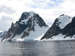
Tierra del Fuego is the southernmost inhabited region in the world, closest to the Antarctic Peninsula and the Circum-Polar Current, the oceanic factor that controls most of the climate around our planet. Peatlands have developed in the central and southern part of Argentine Tierra del Fuego, which allow reconstruction of uppermost Pleistocene–Holocene history of the land. These Fuegian (meaning ‘of Tierra del Fuego’) peatlands are unique environments because of their geographical location, floristic and hydrological nature, ecosystem significance, and paleoenvironmental and paleoclimatic records (Bonarelli, 1917). Indeed, these peatlands can be
considered as environmental data banks, since the sediments accumulated in their layers contain information related to the environmental, ecological and climatic conditions existing in the surrounding region. Owing to their continued sedimentation pattern, a continuous paleoclimatic record can commonly be obtained, which may be constrained with great precision and reliability by means of radiocarbon dating of wood fragments or of the peat itself. Fuegian peatlands are true cathedrals of the paleoenvironmental and paleoclimatic knowledge of southernmost South
America. Therefore, a great effort is needed to preserve them since these ecosystems will work as continuous data archives in the future. Here we present a short review of what is known about the Fuegian peatlands, their nature, distribution, paleoclimatic and paleoenvironmental proxy content, and their relationship with the human settlement of Tierra del Fuego.
Geographic setting
The Isla Grande de Tierra del Fuego is the largest of the Fuegian Archipelago islands, located at the southernmost end of South America, between 531–551 S latitude and 661–741W longitude (Fig. 6.1). Argentine Tierra del Fuego occupies the eastern half of this island; the other half belongs to Chile. Geologically, two crustal plates separated by the tectonically active Magellan transcurrent fault form the island.
Tertiary marine sedimentary rocks that form high plains, isolated hills and low ranges overlie the South American Plate. On the Scotia Plate, the Fuegian Andes are characterized by upper Paleozoic greenschists, a Cretaceous batholith and Mesozoic (early–middle Cretaceous) acid lavas and low-grade, metamorphosed marine sedimentary rocks. Upper Cenozoic glaciers have molded the landscape, with vast plains in the northeastern part of Argentine Tierra del Fuego and rugged mountainous topography to the south. During the Late Pleistocene, only the central
(Lake Fagnano area) and southern parts were glaciated (Coronato et al., 2004). Remnant glaciers still exist in Tierra del Fuego: larger ones, an extensive mountain ice sheet with large outlet glaciers that reach down to sea level, in the western (Chilean) portion of the Fuegian Andes, and small alpine glaciers on the Argentine mountains (Planas et al., 2002).
The regional climate of Argentine Tierra del Fuego is cold, temperate in the south and temperate-oceanic in the north, with an overall mean annual temperature of ca. 51C. Moisture is derived primarily from the south and southwest, and the precipitation distribution is affected by the mountain ranges. Rainfall shows a strong gradient from the southwest, with 600 mm/yr, to the northeast, with less than 300 mm/yr. An east–west precipitation gradient is also evident in the southern part; that is, precipitation increases from the eastern mouth of the Beagle Channel toward the eastern end of the Isla Grande and Staaten Island (Isla de los Estados; up to 1000 mm/yr), due to the penetration of wet, oceanic air masses not obstructed here by the mountain ranges. Maximum precipitation in Argentine Tierra del Fuego occurs in the higher part of the Fuegian Andes, near the border with Chile and at the southernmost end (Fig. 6.1). There, the maximum development of peatland occurs.
In general, the present vegetation of the central and southern part of Argentine Tierra del Fuego belongs to the Sub-Antarctic Deciduous Forest dominion from sea level to 700masl, to the High Andean Alpine Tundra above this altitude.

Methodology for peatland studies
The Fuegian peatlands have been studied so far from the standpoint of pollen, spore, total organic matter, volcanic ash and charcoal particle records. More recent, ongoing research has been oriented toward geochemical studies and analysis of peat ash containing microparticles (mostly volcanic ash and dust particles). For these studies, peatlands are cored to substrate, generally with a Russian-type sampler. The cores are sub-sampled every 10- or 5-cm depth and the samples are later processed in the laboratory, according to the objective of the study (Heusser, 2003). The absolute age of the peat is determined by radiocarbon dating, and the age of the basal peat is taken to indicate the approximate time of initiation of the peatland development.
Pollen flux studies are based in estimating the actual amount of pollen rain falling on the surface of the bog (Heusser, 2003). This is done by means of the artificial incorporation of a known amount of exotic pollen (that is, pollen from a foreign species, not existing in the area today or in the geological past) during the lab processing of each sample. This allows calculation of the actual rate of pollen rain on the bog in the past, since the relationship of the known amount of exotic pollen to the original pollen grains, found in each sample, provides a fair approximation to the environmental conditions at such time. A weak absolute pollen rain of all species represented in the record indicates harsh climatic conditions.
Considering an average peat accumulation rate of about 0.1–0.025 cm/yr, the 5-cm samples provide a time-resolution between 50 and 200 years, depending on the characteristics of the bog, but most likely close to 100 year periods. Knowing the type and distribution of the present vegetation, their ecological and reproductive characteristics, and the mode of dispersal of pollen and spores, it is possible to use them as analogs to reconstruct ancient plant communities and thus, ancient paleoenvironmental and paleoclimatic conditions for specific time periods.
Glacial history of Tierra del Fuego and basal peat chronostratigraphic data
mountain ice-sheet in the Darwin Cordillera (2500masl; 551 S latitude, 691W longitude;
Western Tierra del Fuego, Chile), one of the largest ice bodies in the Southern Hemisphere outside of Antarctica. Large ice tongues (outlet glaciers) discharge from it, reaching or getting close to sea level. In the eastern (Argentine) sector of the island, the ice bodies are restricted to cirque glaciers, a few small, high altitude valley glaciers and limited snowfields in the higher zones.
Repeated glaciations took place in Patagonia and Tierra del Fuego since the latest Miocene (Mercer, 1976; Clapperton, 1993). During the Quaternary, several large glaciers descended a number of times from the Darwin Cordillera to cover all or part of Tierra del Fuego. Those which are most important for the landscape evolution of Eastern Tierra del Fuego were the Magellan Glacier, the largest glacier that ever existed in the Southern Hemisphere during Cenozoic times outside of Antarctica, the Fagnano Glacier and the Beagle Glacier (Fig. 6.1; Porter, 1990; Meglioli, 1992; Rabassa et al., 1992, 2000; Clapperton, 1993; Isla and Schnack, 1995). Caldenius
(1932) mapped the distribution of Fuegian and Patagonian glaciations. The glacial features indicate that, probably, the entire island was ice-covered before 1 million years ago. The Great Patagonian Glaciation (GPG), the maximum expansion in Extra-Andean Patagonia, occurred between 1.15 and 1.01 million years ago, during the oceanic oxygen isotope stages (OIS) 34–30 (Ton-That et al., 1999; Rabassa and Coronato, 2002). All subsequent glaciations were less extensive. The number of glacial advances that took place in Tierra del Fuego is still a matter of debate (Rabassa et al., 1990b; Meglioli, 1992). In any case, during the glacial maxima, including the Last Glacial Maximum (LGM, ca. 24,000–25,000 cal yr BP; Kaplan et al., 2004), the
exposed surface of Tierra del Fuego was at least twice the present one due to lowering of sea level, allowing for a much larger degree of continentality than today (Rabassa et al., 1992, 2000). The marine coast displacement was at least 150 km eastwards. For this reason, the periglacial environments were characterized by a tundra environment and, farther eastwards, by an extensive herbaceous and shrubby steppe, similar to that existing today in continental Patagonia. Finally, somewhere in easternmost Tierra del Fuego, refugia of the Fuegian forest may have persisted, which allowed recolonization during interglacial times (Fig. 6.1; Coronato et al., 1999).
The Upper Pleistocene Darwin Cordillera ice cap and the associated Beagle Channel and Lake Fagnano lobes/outlet glaciers are most important in shaping the landscape over which the most important latest Pleistocene/Holocene peatlands of Argentine Tierra del Fuego formed (Figs. 6.1, 6.2). Conversely, the basal peat dates of the various peatlands allow an accurate reconstruction of the deglaciation stages of these areas, and of the Beagle Channel in particular. The glacial and periglacial processes left a legacy of steeply eroded mountain flanks, deep entrenched valleys, a local drumlin field (Harberton area; Rabassa et al., 1990c, 1992, 2000), several end moraines that locally dammed lacustrine settings and a series of alluvial fans
(Coronato and Roig, 1999; Coronato et al., 2006 – this book, Ch. 5). The peatlands development was intimately associated with such landscape. They developed preferentially by the damming of the surficial runoff in the deglaciated terrains, forming small lakes and ponds, which were later occupied by aquatic vegetation, mostly mosses and grasses, from which peat accumulation started.
During the Late Pleistocene, the glaciers started to recede significantly from the southern part of Argentine Tierra del Fuego around 15,000 or 16,000 14Cyr BP.
The dates obtained from the basal peat layers provide an approximate time for the progression of the deglaciation and for postglacial emersion of the coastal areas (Fig. 6.2). Peatlands started forming in the eastern area at least about 15,000 14Cyr BP (Heusser, 1989a, 2003), but most in the Ushuaia area are only as old as 12,000–13,000 14Cyr BP, whereas in the Fuegian Andean valleys they are less than 10,000 14Cyr BP (Coronato, 1990, 1993, 1995).

The complex deglaciation of the Beagle Channel valley could be deciphered because of the information provided by the peatlands basal ages. For instance, a first event of deglaciation is shown by the Harberton Bog basal radiocarbon age of 14,6807100 14Cyr BP (Rabassa et al., 1990a), somewhat 50km west of the terminal, LGM Moat moraines. Probably then the ice front reached the Isla Gable rise, which it later abandoned in a second deglaciation event, as suggested by the basal 14C age of the Caleta Ro´ balo bog (12,700790 14Cyr BP; Heusser, 1989b). Then, the main Beagle Glacier receded from the cirques, allowing their glaciers to expand down slope.
Radiocarbon dating of basal peat of 12,060760 14Cyr BP at the Pista de Ski moraine (Ushuaia, at ca. 300masl) suggests that this retreat phase probably peaked ca. 12,000 14Cyr BP, when a relative maximum of arboreal pollen was reached eastwards, at Puerto Harberton (Rabassa et al., 1990a), at 11,7807110 14Cyr BP. In spite of the formation of the Late Glacial lateral moraines, the basal 14C ages of the Ushuaia 2 (80masl; 12,430780 yr BP) and Ushuaia 3 (10masl; 12,100750 yr BP) bogs show that the ice would have already disappeared from these sites allowing the formation of ice-marginal, lacustrine environments (Heusser, 1998). The similarity of the bog basal ages between 300 and 10masl in Ushuaia suggests that the ice recession had taken place in a single phase. Although the pollen profiles in these peatlands show evidence of cooling between 11,000 and 10,000 14Cyr and subsequent vegetation changes
(Heusser and Rabassa, 1987), perhaps the climatic conditions had not been harsh enough so as to alter the Beagle Glacier dynamics and to allow the ice stabilization and interrupt the general headward recession. The ca. 10,000 14Cyr BP glacial retreat was definitive: basal peat layers of Punta Pingu¨ inos in Ushuaia (20masl) and Bahía Lapataia (20km westwards, 18masl) show 14C ages of 10,080 yr BP (Rabassa et al., 1990a), a condition observed also for the glaciers that were tributaries to the glaciation axis located in the easternmost end of the island – 661W longitude, Bahía Aguirre – where the basal age of fossil peat reached 10,920770 14Cyr BP (Rabassa
et al., 2000). The Late Glacial–lower Holocene peat depositional sequence has been recently studied concerning its palynological and paleoclimatic aspects (Borromei et al., in press),confirming the existence of a cold period around 10,000 14Cyr BP.
The geomorphologic evidence found in the Fuegian Andes indicates that the definitive deglaciation process would have started after 10,000 14Cyr BP. Recession followed the Late-Glacial maxima and evidence for several Neoglacial readvances are observed in the cirques, but no absolute chronology has been established yet.
Peat accumulation rates
of Patagonia and Tierra del Fuego. Profiles of biogenic deposits formed in peatlands and alluvial and lacustrine deposits were analyzed to ascertain theiraccumulation rate. The maximum accumulation rate for a given period has been established in 3.0 mm/yr, and the mean accumulation rate for one single site has been estimated between 0.51 and 0.93 mm/yr, at least during the Late Quaternary (see diagrams in Rabassa et al., 1989). It reflects among other factors, climatic changes and the compaction processes that the sediments have undergone. Statistically, most of the best-fitted regression equations are of the type y ¼ axb and the determination coefficients obtained are very large (40.84, most of them 40.9), indicating that almost the entire variance may be explained by these functions.
The b coefficient, always different from 1, indicates that the accumulation rate is not linear. These coefficients also suggest that, at least in the studied sequences, no significant hiatus in the sedimentary process has ever taken place. These data also suggest that it is possible to extrapolate with some confidence the age of a peat layer intermediate between dated horizons. The rate of growth of the bog may vary with time, and it is probably related to environmental and climatic conditions. Two episodes of high accumulation rate have occurred in this region, during the latest Pleistocene (ca. 10,000 14Cyr BP) and the Late Holocene (between 2500 and 3000 14Cyr BP). These high accumulation rates correspond to climatic conditions that favored peat accumulation, most likely due to higher annual precipitation. Similarly,a lower accumulation rate took place around ca. 6000 14Cyr BP, perhaps due to lower primary productivity during Hypsithermal times. Probably, mean annual precipitation has been the dominant factor controlling growth and evolution of peatlands, and therefore, the accumulation rate of the organic sediments in them. Heusser (2000) applied the same criteria to the Puerto del Hambre (Magellan Strait, Chile) mire, obtaining a similar, overall sedimentation rate of 0.61 mm/yr, for the last 14,700 14Cyr BP.
The occurrence of Holocene tephras in Fuegian peatlands Volcanic ashes accumulate and they are well preserved in peatlands, particularly in bogs. These ashes have been blown from distant sources in continental Patagonia, since no tephra-producing volcanoes are known in the Fuegian archipelago. Up to four different ash layers were already described by Auer (1956, 1958, 1965), and correlated to various tephra beds he had recognized in Patagonia. The oldest one was
of Late Glacial age, and the other three were deposited during the Holocene. This stratigraphic framework is today under revision, since the pyroclastic activity on the continent seems to have been much more complex than previously thought.
A sequence of ash events was presented by Stern (1990), who described and geochemically identified ash falls as pertaining to pyroclastic eruptions coming from the Andean volcanoes Reclus, Aguilera, Lautaro, Hudson and Barney, in continental South America. Many different tephra layers have been recorded in Fuegian bogs between 14,150 and 2700 14Cyr BP (Heusser and Rabassa, 1995; Heusser, 2003), but the volcanic activity of the Patagonian volcanoes has continued until present times,as the large eruption of Mt. Hudson in 1991, whose wind-blown ashes occur at or very near the surface of the Fuegian peatlands.
Coastal wetlands
The coastal wetlands of Tierra del Fuego have not been as thoroughly investigated as the inland peatlands. The only major exception is the La Misión Bog, north of Río Grande, along the Holocene marine terrace. This wetland has been studied by Auer (1959, 1974) and Markgraf (1980). At this site, wetland stratigraphy displays an intercalation of marine sediments corresponding to the mid-Holocene transgression (Porter et al., 1984). A Holocene lake (at a present level of 5.7m below high tide level) was flooded by the marine transgression about 9000 14Cyr BP and a tidal flat developed at an altitude of 0.9m above high tide level at 4000–2000 14Cyr BP. Other important sites related to coastal wetlands are the alluvial–littoral deposits described at Bahía Lapataia (Rabassa et al., 1986; Gordillo et al., 1993), where a thin peat layer
is covering metamorphic rocks and is overlain by lower Holocene marine deposits, whose shells gave a radiocarbon age of 8200 yr BP. The underlying peat bed has yielded a radiocarbon age of 7700 yr BP at its top layers. Thus, a minimum 500-year reservoir effect can be established for radiocarbon dating of marine shells in this portion of the Beagle Channel, since the radiocarbon age of the underlying peat layer may be taken as much closer to the true age. At Rı´o Varela, just east of Estancia Harberton, mid-Holocene peat and alluvial deposits, presently under high-tide sea level (Grill et al., 2002), have proven that different parts of the Beagle Channel have
had different tectonic behavior during the Late Holocene (Bujalesky et al., 2004).
This fact is also indicated by alluvial and organic deposits in former lagoon deposits,
including remnants of a submerged forest at Bahía Sloggett, eastern Tierra del Fuego
(Rabassa et al., 2004).
Climatic variability as demonstrated by proxy elements
(in Bujalesky et al., 1997; Heusser, 2003). It corresponds to fossil peat beds, intercalated
in lacustrine/diatomite deposits, marginal to a major lowland glacier, perhaps
during the termination of a glacial stage, most likely OIS six or four. These fossil peat
beds have been radiocarbon dated at 38,000 yr BP and greater than 51,000 yr BP,
suggesting a Late Pleistocene age (Fig. 6.3).

times, retiring eastwards to a still uncertain refuge. The forest had been then replaced
by a tundra–shrubby steppe association (Heusser, 2003).
along the Beagle Channel, was apparently warmer between 14,600 and 13,000 14Cyr
and between 11,700 and 11,160 14Cyr BP. Climate became cooler earlier than 13,000
until 12,000 14Cyr BP, and from around 11,160 until 10,200–10,000 14Cyr BP. This
last cooling episode suggests the development of a Younger Dryas event in this part
of the Southern Hemisphere, where the estimated summer temperature was o31C
lower than the present at Ushuaia (Heusser and Rabassa, 1987; Heusser, 1998). The
Late Glacial pollen signal is characterized by a fast recovery of the Nothofagus forest
almost immediately after deglaciation, that is, sometimes before 16,000 14Cyr BP.
The basal deposits at the Harberton Bog are showing an unusually large content of
tree pollen between 14,600 and 14,000 14Cyr BP (Rabassa et al., 1990a; Fig. 6.4).
This initial pollen content decreases later to two minima, the first one between 13,000
and 12,000 14Cyr BP and the second between 11,000 and 10,000 14Cyr BP, with an
intermediate rise. This is also shown by pollen influx diagrams (Heusser, 2003). These
two episodes have been interpreted as relatively cold and dry climatic events, with
displacement of the Nothofagus forest outside of the region, and its replacement by
an impoverished tundra environment (Heusser, 1989a). Similar conditions have been
identified in the Ushuaia 1, Ushuaia 2 and Caleta Ro´ balo sections (Heusser, 2003).
Whether these Late Glacial cold and dry events can be timely correlated to the North
Atlantic Older Dryas and Younger Dryas events is still debated (Heusser and
Rabassa, 1987; Heusser, 1989a, b, 2003; Markgraf, 1991).
Holocene pollen records
Numerous Holocene peatlands occur all over the island of Tierra del Fuego. The pollen records show that, after the Late Glacial fluctuations already mentioned, milder Holocene climate was established between 10,000 and 9000 14Cyr BP, allowing the progressive occupation of the land by the forest. First an open forest condition and later to the present, closed forest environment were established, as indicated by the increase of tree pollen over the steppe shrub and herb species.
Several climatic oscillations have been recorded for the Holocene of the island, with a definitive installation of the forest around 6000 14Cyr BP, achieving present climatic conditions. The existence of Neoglacial oscillations is not yet clearly identifiable in the pollen record, though detailed studies in mires located in higher valleys of the Fuegian Andes are presently being carried on. The formation of the Nothofagus woodland under the postglacial climatic amelioration started toward 10,000 14Cyr BP in southern Tierra del Fuego, but it was not until 5000 14Cyr BP that the closed forest developed, under wetter and cooler conditions (Heusser, 1989b), when the peatland rate of sedimentation increased as well (Rabassa et al., 1989). In northcentral
Tierra del Fuego, in the forest/steppe ecotone area, a pollen record at Cabo San Pablo (Heusser and Rabassa, 1995) suggests that the behavior of the forest in those areas is different from what has been observed along the Beagle Channel
(Fig. 6.5).

On the northern slopes of the Fuegian Andes, the woodland stabilization took place around 8000 14Cyr BP, but only after 5000 14Cyr BP the forest established with open spaces until it reached a more recent, definitive expansion, as shown in the pollen profile of Cabo San Pablo. In this San Pablo contact zone between the deciduous forest and the steppe, the open forest developed toward ca. 3000 14Cyr BP, although with presence of steppe pastures. As indicated by the Nothofagus pollen content, the definitive expansion of the forest occurred toward 900 14Cyr BP, becoming more intense after 300 14Cyr BP due to the increasing humidity coming from
the Southern Pacific and the weakening of the subtropical anticyclonic cells (Heusser
and Rabassa, 1995; Heusser, 2003). This delay in forest recovery shows continentality
conditions, which has also been observed in other sections around Lake Fagnano. Recently, Mauquoy et al. (2004) have identified the existence of a warm period in the Late Holocene of Tierra del Fuego. Changes in temperature and/or precipitation were inferred from different proxy sources, such as plant macrofossils, pollen, fungal spores, testate amebae and peat humification in peat monoliths collected from the Andorra Valley. Mauquoy et al. (2004) report evidence for a period of warming-induced drier conditions from 960 to 1020 AD, which may correspond to the Medieval Warm period in Europe (950–1045 AD) suggesting that this was a global warm period, synchronous in both hemispheres (Borromei et al., in press).
In summary, the pollen data suggest that the steppe was dominant in northern Tierra del Fuego until the Nothofagus forest colonization. The paleoenvironment from middle to Late Holocene was characterized by a shrubby steppe with drier and probably colder climatic conditions than the present ones in the area, while the forest would have migrated to the east and south alternatively and irregularly as can be checked from the Lake Fagnano profile, ca. 5000 years BP (Heusser, 1994a); thus, the forest was completely settled close to Onamonte (central Tierra del Fuego, Chile) ca. 1500 years BP and in Cabo San Pablo toward 1000 years BP (see Fig. 6.4;
Heusser, 1993; Heusser and Rabassa, 1995).
 Dendrochronology
 Numerous tree trunks (many of them still rooted) in excellent degree of preservation were found in two bogs near Ushuaia (Carbajal and Monte Gallinero), among other sites. They have allowed a detailed dendrochronological study by Roig Jun˜ ent et al. (1996), supported by several radiocarbon dates and cross-dating techniques, covering at least for the last 3770 years, of which over the last 1500 years consist of a continuous record, one of the oldest in the Southern Hemisphere (Fig. 6.6).

Bogs and archeology
Human colonization in Tierra del Fuego dates from ca. 11,000 14Cyr BP, when a group of hunters occupied the NW portion of the island, as shown by cultural and faunal remains found in the Tres Arroyos site (Massone, 1987; Borrero, 1999). At Figure 6.6. Floating index tree-ring width chronology of the Carbajal Valley (541 440 S latitude, 681 130W longitude) taken from Nothofagus wood and trunks contained in peatlands layers (after Roig Jun˜ ent et al., 1996). The relative position of each record is based on radiocarbon age. The solid underlines correspond to 14C age (years BP7sigma) and the broken lines correspond to the range of age according to the Northern Hemisphere calibration curve. The AD years of horizontal scale are derived directly from living trees or from radiocarbon ages of dead wood calibrated following the Northern Hemisphere curve because there are not yet calibration curves for the Southern Hemisphere. (Diagram (a) continues into diagram (b) for older times).
At that time, the Isla Grande of Tierra del Fuego was still part of the continent (McCulloch et al., 1997). These hunters reached the island from southernmost Patagonia, before the definitive retreat of the glaciers, and became isolated from their original populations in the continent after the opening of the Magellan Straits. An open steppe-environment is indicated by the faunal species recorded as well as the Bahía Inútil pollen profile that shows a high proportion of steppe elements (Heusser,1994a); this could have been the space where these colonizers moved. However, early settlement on the Isla Grande of Tierra del Fuego is suggested by charcoal particles detected in the aforementioned pollen profiles (Heusser, 1987, 1994b). Fire in the landscape of this region, where no volcanoes are present and lightning storms are very unusual, is mostly attributed to Paleoindian activity (Heuseer, 1994b, 2003 p. 74). If this were correct, the presence of charcoal in the Upper Pleistocene sections of central Chile (Heusser, 2003, p. 110) may suggest that humans would have arrived to these regions about the mid-portion of OIS 3, between 30,000 and 443,000 14Cyr BP (Laguna de Tagua-Tagua). A hiatus in charcoal findings during the OIS 2 occurs in the record (Heusser, 2003), suggesting that very cold climate at the peak of LGM would have forced the aborigines to retreat equatorwards. They would have returned to Patagonia and Tierra del Fuego later in Late Glacial times (Heusser, 2003). Early human occupation at Monte Verde, Chile (Dillehay and Pino, 1989; dated at 12,500 14Cyr BP) and Piedra Museo, Argentine Patagonia (Coronato et al., 1999; dated at 12,890 14Cyr BP) supports the use of charcoal evidence to follow the migration of Paleoindian hunters. The Bahı´a Inu´ til profile shows a high content of charcoal particles as early as 13,300 14Cyr BP, and, moreover, the Puerto del Hambre section (Heusser, 2003) provides a very high charcoal content between 12,300 and 414,500 14Cyr BP, which may indicate a human presence in the region, much earlier than previously known. In the Beagle Channel, peatland profiles at Lapataia, Caleta Róbalo and Puerto Harberton show a sudden appearance of charcoal particles around ca. 10,000 14Cyr BP. The Ushuaia sections indicate, however, the occurrence of charcoal particles as early as 12,100 14Cyr BP (Heusser, 2003). If this charcoal were actually of anthropogenic origin, the presence of humans in the Beagle Channel would be more than 5000 years older than indicated by the now existing archeological record.
The Fuegian peatlands have greatly contributed to the scientific interpretation of the upper Quaternary environments of southernmost South America. Nevertheless, much more information remains to be obtained from them concerning the environmental changes in the Southern Hemisphere during the last 15,000 radiocarbon years.
The low environmental and atmospheric pollution of Tierra del Fuego provides appropriate conditions to establish comparison parameters on the variability of atmospheric composition by means of stable isotopes. From a geological point of view, the record of ancient volcanic eruptions allows analysis of the recent history of the crustal dynamics in a region that is tectonically unstable and of high scientific interest.
Moreover, the progressive knowledge of the peatlands stratigraphy wouldThe peatlands of Argentine Tierra del Fuego 141 allow us to relate the changes in lithological composition to the environmental changes, as suggested by geomorphologic and palynological studies.
The peatlands of Tierra del Fuego may contribute to the understanding of the natural history and the early peopling of this region of the Southern Hemisphere and its inter-hemispheric relationships. Our present and forthcoming studies point toward deglaciation chronologies, detailed studies of the Late Glacial pollen sections, particularly the Antarctic Cold Reversal and the Younger Dryas events, and its relationship with geomorphologic evidence, the Neoglacial and Little Ice Age chronology, and the preparation of a long-term dendrochonological curve that could be used in the calibration of a 14C curve for the Southern Hemisphere. These are some of the many fascinating scientific problems of the Quaternary of Tierra del Fuego in which peatlands are expected to provide us with reliable and detailed information.
References
Auer, V., 1956. The Pleistocene of Fuego-Patagonia. Part 1: The ice and interglacial ages. Annales Acad.
Sci. Fenn., Ser.A. III Geol.-Geogr. 45, 1–226.
Auer, V., 1958. The Pleistocene of Fuego-Patagonia. Part 2: The history of the flora and vegetation.
Annales Acad. Sci. Fenn., Ser. A. III Geol.-Geogr. 50, 1–239.
Auer, V., 1959. The Pleistocene of Fuego-Patagonia. Part 3: Shoreline displacement. Annales Acad. Sci.
Fenn., Ser. A. III Geol.-Geogr. 60, 1–247.
Auer, V., 1965. The Pleistocene of Fuego-Patagonia. Part 4: Bog profiles. Ann. Acad. Sci. Fenn., Ser. A.
III Geol.-Geogr. 80, 1–160.
Auer, V., 1974. The isorhythmicity subsequent to the Fuego-Patagonian and Fennoscandian ocean level
transgressions and regressions of the last glaciation. Ann. Acad. Sci. Fenn., Ser. A., III Geol.-Geogr.
115, 1–88.
Bonarelli, G., 1917. Tierra del Fuego y sus turberas. An. Ministerio Agric. Sec. Geol. (Buenos Aires) 12 (3) .
Boninsegna, J., 1992. South American dendrochronological records. In: Bradley, R.S. and Jones, P.D.
(Eds), Climate Since A.D. 1500. Routlegde, London, pp. 446–462.
Boninsegna, J., Keegan, G.C., Jacoby, R., et al., 1990. Dendrochronological studies in Tierra del Fuego.
Quatern. South America Antarctic Peninsula 7, 305–326.
Borrero, L., 1999. Human dispersal and climatic conditions during Late Pleistocene times in Fuego-
Patagonia. Quatern. Int. 53/54, 93–99.
Borromei, A., Coronato, A.M.J., Quattrocchio, M., et al. (in press). Late Pleistocene–Holocene environments
in Valle Carbajal, Fuegian Andes, Southern South America. J. South American Earth Sciences.
Bujalesky, G., Coronato, A.M.J., Roig, C., et al., 2004. Holocene differential tectonic movements along
the Argentine sector of the Beagle Channel (Tierra del Fuego) inferred from marine paleoenvironments.
GEOSUR 2004. International Symposium on the Geology and Geophysics Southernmost
Andes, Buenos Aires, November 2004 (extended abstract).
Bujalesky, G., Heusser, C.J., Coronato, A.M.J., et al., 1997. Pleistocene glaciolacustrine sedimentation at
Lago Fagnano, Andes of Tierra del Fuego, southernmost South America. Quatern. Sci. Rev. 16,
767–778.
Caldenius, C., 1932. Las glaciaciones cuaternarias en la Patagonia y Tierra del Fuego. Geografiska
Annaler 14, 1–164.
Clapperton, C.M., 1993. Quaternary Geology and Geomorphology of South America. Elsevier,
Amsterdam, 779pp.
Coronato, A.M.J., 1990. Definicio´ n y alcance de laU´ ltima Glaciacio´ n Pleistocena – Glaciacio´ nMota- en el
valle de Andorra, Tierra del Fuego, Argentina. XI Congreso Geolo´ gico Argentino, San Juan,
Argentina, Actas I, 286–289.
142 J. Rabassa et al.
Coronato, A.M.J., 1993. La Glaciacio´ n Moat (Pleistoceno Superior) en los valles Pipo y Can˜ ado´ n
del Toro, Andes Fueguinos. XII Congreso Geolo´ gico Argentino, Mendoza, Argentina, Actas VI,
40–47.
Coronato, A.M.J., 1995. The last Pleistocene glaciation in tributary valleys of the Beagle Channel, southernmost
South America. Quatern. South America Antarctic Peninsula 9, 173–182.
Coronato, A.M.J., Meglioli, A., and Rabassa, J., 2004. Glaciations in the Magellan Straits and Tierra del
Fuego, Southernmost South America. In: Ehlers, J. and Gibbard, P. (Eds), Quaternary Glaciations:
Extent and Chronology. Part III: South America, Asia, Africa, Australia and Antarctica. Developments
in Quaternary Science. Elsevier, Amsterdam.
Coronato, A.M.J. and Roig, C., 1999. Peligro geomorfolo´ gico en ambientes de ge´nesis reciente. Valles de
Tierra Mayor y Rı´o Olivia. I Congreso Argentino de Geomorfologı´a y Cuaternario, Santa Rosa,
Argentina. Actas 1, 123–132.
Coronato, A.M.J., Roig, C., Roig Jun˜ ent, F., et al. 2006 (this book, Chapter 5). Geomorphologic
emplacement and vegetation characteristics of Fuegian peatlands, southernmost Argentina, South
America. In: Martini, I.P., Matı´nez Cortizas, A., and Chesworth, W. (Eds.), Peatlands: Evolution and
Records of Environmental and Climatic Changes. Elsevier, Amsterdam.
Coronato, A.M.J., Salemme, M., and Rabassa, J., 1999. Paleoenvironmental conditions during the early
peopling of southernmost South America (Late Glacial–Early Holocene, 14–9 ka B.P.). Quatern. Int.
53/54, 77–92.
Dillehay, T. and Pino, M., 1989. Stratigraphy and chronology. In: Dillehay, T.D. (Ed.), Monte Verde.
A Late Pleistocene Settlement in Chile. Paleoenvironmental and Site Context. Smithsonian Institution
Press, Washington, DC, USA, Vol. 1, pp. 133–145.
Gordillo, S., Coronato, A.M.J., and Rabassa, J., 1993. Late Quaternary evolution of a subantarctic
paleofjord, Tierra del Fuego. Quatern. Sci. Rev. 12, 889–897.
Grill, S., Borromei, A., Quattrocchio, M., et al., 2002. Palynological and sedimentological analysis of
recent sediments from Rı´o Varela, Beagle Channel, Tierra del Fuego, Argentina. Rev. Espan˜ ola de
Micropaleontol. 34, 145–161.
Heusser, C.J., 1987. Fire history of Fuego-Patagonia. Quatern. South America Antarctic Peninsula 5,
93–109.
Heusser, C.J., 1989a. Climate and chronology of Antarctica and adjacent South America over the past
30,000 yr. Palaeogeogr. Palaeoclim. Palaeoecol. 76, 31–37.
Heusser, C.J., 1989b. Late Quaternary vegetation and climate of southern Tierra del Fuego. Quatern. Res.
31, 396–406.
Heusser, C.J., 1993. Late Quaternary forest-steppe contact zone, Isla Grande de Tierra del Fuego,
subantarctic South America. Quatern. Sci. Rev. 12, 169–177.
Heusser, C.J., 1994a. Three Late Quaternary pollen diagrams from Southern Patagonia and their palaeoecological
implications. Palaeogeogr. Palaeoclim. Palaeoecol. 118, 1–24.
Heusser, C.J., 1994b. Paleoindians and fire during the late Quaternary in southern South America. Rev.
Chilena de Historia Natural. 67, 435–443.
Heusser, C.J., 1998. Deglacial paleoclimate of the American sector of the Southern Ocean: Late
Glacial–Holocene records from the latitude of Canal Beagle (551C), Argentine Tierra del Fuego.
Palaeogeogr. Palaeoclim. Palaeoecol. 141, 277–301.
Heusser, C.J., 2000. Deglacial palaeoclimate at Puerto del Hambre, subantarctic Patagonia, Chile.
J. Quatern. Sci. 15, 101–114.
Heusser, C.J. 2003. Ice Age Southern Andes: A Chronicle of Palaeoecological Events. Elsevier,
Amsterdam, 40pp.
Heusser, C.J. and Rabassa, J., 1987. Cold climate episode of younger Dryas age in Tierra del Fuego.
Nature 328, 609–611.
Heusser, C.J. and Rabassa, J., 1995. Late Holocene forest steppe interaction at Cabo San Pablo, Isla
Grande de Tierra del Fuego, Argentina. Quatern. South America Antarctic Peninsula 9, 179–188. Isla, F. and Schnack, E., 1995. Submerged moraines offshore northern Tierra del Fuego, Argentina.
Quatern. South America Antarctic Peninsula 9, 205–222.
Kaplan, M., Ackert, R. Jr., Singer, B., et al., 2004. Cosmogenic nuclide chronology of millennial-scale
glacial advances during O-isotope stage 2 in Patagonia. Geol. Soc. Am. Bull. 116, 308–321.
The peatlands of Argentine Tierra del Fuego 143
Markgraf, V., 1980. New data on the late and postglacial vegetational history of ‘‘La Misio´ n’’, Tierra del
Fuego, Argentina. Proceedings of the IV International Palynological Congress, Lucknow, India,
Vol. 3, pp. 68–74.
Markgraf, V., 1991. Younger Dryas in southernmost South America? Boreas 20, 63–69.
Massone, M., 1987. Los cazadores paleoindios de Tres Arroyos (Tierra del Fuego). An. Ins. de la Patagonia
17, 47–60.
Mauquoy, D., Blaauw, M., van Geel, B., et al., 2004. Late Holocene climatic changes in Tierra del Fuego
based on multiproxy analyses of peat deposits. Quatern. Res. 61, 148–158.
McCulloch, R.D., Clapperton, C.M., Rabassa, J., et al., 1997. The natural setting. The glacial and postglacial
environmental history of Fuego-Patagonia. In: Mc Ewan, C., Borrero, L.A., and Prieto, A.
(Eds), Patagonia. Natural History, Prehistory and Ethnography at the Uttermost End of the Earth.
British Museum, London, pp. 12–31.
Meglioli, A., 1992. Glacial geology and chronology of Southernmost Patagonia and Tierra del Fuego,
Argentina and Chile. Unpublished PhD Dissertation, Lehigh University, Bethlehem, Pennsylvania,
216pp.
Mercer, J., 1976. Glacial history of southernmost South America. Quatern. Res. 6, 125–166.
Planas, X., Ponsa, A., Coronato, A.M.J., et al., 2002. Geomorphological evidence of different glacial
stages in the Martial Cirque, Fuegian Andes, southernmost South America. Quatern. Int. 87, 19–27.
Porter, S., 1990. Character and ages of Pleistocene drifts in a transect across the Strait of Magellan.
Quatern. of South America Antarctic Peninsula 7, 35–50.
Porter, S., Stuiver, M., and Heusser, C.J., 1984. Holocene sea level changes along the Strait of Magellan
and Beagle Channel, southernmost South America. Quatern. Res. 22, 59–67.
Rabassa, J., Bujalesky, G., Meglioli, A., et al., 1992. The Quaternary of Tierra del Fuego, Argentina: the
status of our knowledge. Sveriges Geol. Underso¨ kning, Ser. Ca 81, 249–256.
Rabassa, J. and Coronato, A.M.J., 2002. Glaciaciones del Cenozoico tardı´o. In: Haller, M. (Ed.), Geologı´a
y recursos naturales de Santa Cruz, Relatorio del XV Congreso Geolo´ gico Argentino, El Calafate 1
(19), 303–315.
Rabassa, J., Coronato, A.M.J., Bujalesky, G., et al., 2000. Quaternary of Tierra del Fuego, southernmost
South America: an updated review. Quatern. Int. 68–71, 217–240.
Rabassa, J., Coronato, A.M.J., Roig, C., et al., 2004. Un bosque sumergido en Bahı´a Sloggett, Tierra
del Fuego, Argentina: evidencia de actividad neotecto´ nica diferencial en el Holoceno tardı´o. In:
Blanco Chao, R., Lo´ pez-Bedoya, J., and Pe´rez Alberti, A. (Eds), Procesos geomorfolo´ gicos y evolucio´ n
costera. Cursos e Congresos N1 145. Universidad de Santiago de Compostela, Spain, pp. 333–346.
Rabassa, J., Heusser, C.J., and Coronato, A.M.J., 1989. Peat-bog accumulation rate in the Andes of Tierra
del Fuego and Patagonia (Argentina and Chile) during the last 43,000 years. Pirineos 133, 113–122.
Rabassa, J., Heusser, C.J., and Rutter, N., 1990a. Late-Glacial and Holocene of Tierra del Fuego. Quatern.
South America Antarctic Peninsula 7, 327–351.
Rabassa, J., Heusser, C.J., and Stuckenrath, R., 1986. New data on Holocene sea transgression in the
Beagle Channel, Tierra del Fuego. Quatern. South America Antarctic Peninsula 4, 291–309.
Rabassa, J., Serrat, D., Martı´, C., et al., 1990b. El Tardiglacial en el Canal Beagle, Tierra del Fuego,
Argentina. Actas XI Congreso Geolo´ gico Argentino 1, 290–293.
Rabassa, J., Serrat, D., Martı´, C., et al., 1990c. Internal structure of drumlins in Gable Island, Beagle
Channel, Tierra del Fuego, Argentina. LUNDQUA Report, Lund, 32, pp. 3–6.
Roig Jun˜ ent, F., Roig, C., Rabassa, J., et al., 1996. Fuegian floating tree-ring chronology from subfossil
Nothofagus wood. Holocene 6, 469–476.
Stern, C.R., 1990. Tephrochronology of southernmost Patagonia. Natl. Geogr. Res. 6, 110–126.
Ton-That, T., Singer, B., Mo¨ rner, N., et al., 1999. Datacio´ n de lavas basa´ lticas por 40Ar/39Ar y geologı´a
glacial de la regio´ n del Lago Buenos Aires, provincia de Santa Cruz, Argentina. Rev. Asoc. Geol.
Argentina 54, 333–352.
Villalba, R., Boninsegna, J.A., Veblen, T., et al., 1997. Recent trends in tree-ring records from high elevation sites in the Andes of Northern Patagonia. Clim. Change 36, 425–454.
ISSN: 0928-2025 DOI: 10.1016/S0928-2025(06)09006-7